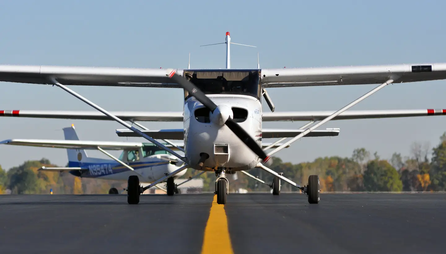
I admit it, I'm spoiled. For a 33-year-old airplane my Cessna Cardinal RG is very well equipped. Fitted with a Garmin (née UPS) GNS 480 navigator, a Garmin GMX 200 multifunction display and an S-Tec System 30 autopilot with a Pitch Stabilization System, my airplane doesn't give up a whole lot to the new kids on the block with their Avidyne Entegras or Garmin G1000s and GFC 700 autopilots. Sure there are some nice advantages to the boxes with the latest technology, but we got along without them very well before we met them and we can get along without them now.
For years I flew my Cardinal single-pilot in instrument meteorological conditions (IMC) with a pair of VORs and an aging Cessna Navomatic 300A autopilot that with luck and constant monitoring would hold a heading. Theoretically capable of intercepting and tracking a VOR or localizer course, it rarely deigned to add those functions to its to-do list.
But today, given a Sophie's choice, I'd be hard-pressed to decide which tool to do without on a flight in instrument meteorological conditions. Thinking about it initially, I thought I'd be torn between giving up an IFR-approved GPS or a working autopilot.
The decision became more obvious during a local flight in anticipation of a longer cross-country jaunt when I tried to engage the autopilot "heading" mode on my S-Tec 30 and the Push Mode Switch refused to work properly. The switch normally lets me engage the various roll modes but when I pushed the knob it didn't make contact.
Without the autopilot, I flew an IFR flight in VFR conditions to Hagerstown, Maryland. With just a bit of scalloping when my attention was diverted to change frequencies or access information from the chart, I did a pretty good job of staying well within the lateral limits of the airways, within 100 or so feet of the assigned altitudes, and I kept the needles close to center on the ILS approach to Runway 27.
| ** George DeBeeson, pilot/inventor, patented an Automatic Airplane Control autopilot in 1931** (Photo: www.debeeson.com) |
A couple days later I had to fly to Plymouth, Massachusetts, where I was invited to speak to the Plymouth Aero Club. The flight reminded me that there's a real difference flying IFR in visual meteorological conditions or in solid IMC and just how helpful it is to have "George" on board reliably holding headings and tracking the course. (One explanation of why the autopilot is traditionally called "George" is because George DeBeeson, a pilot/inventor, patented an "Automatic Airplane Control" autopilot in 1931.)
The flight would be in IMC with low ceilings en route but no ice, turbulence or convective activity in the forecast. With the recent experience of the Hagerstown flight I felt comfortable launching on the flight without "George's" help. I transitioned to instruments about 900 feet above the airport and didn't see the ground again until I broke out on the ILS at Plymouth.
Shortly after departure, I was given a routing change that required me to edit the flight plan on the GNS 480. One of the nice features of the 480 is the airway flight planning, so making the necessary changes literally took only seconds. But when I looked up I was amazed at how quickly the airplane had gotten off course. I was off the heading by about 40 degrees and in a bank that was rapidly taking me farther off course. I corrected but it seemed to take forever to get back on course, certainly much more time than it had taken to get led astray.
The flight home from Plymouth was again in solid IMC and again I was given a change of routing shortly after takeoff; reinforcing the reason a working -- and reliable -- autopilot is a valued companion, particularly for a single pilot flying IFR. Both flights to and from Plymouth were just a bit longer than an hour, but flying single pilot in instrument conditions without an autopilot requires constant scanning of the instruments, interpreting what they're telling you and reacting appropriately. It's exhausting.
The AWOS at Columbia County when I returned from Plymouth was reporting the wind at about five knots -- favoring Runway 21 -- but the ceiling was missing from the recording. The temperature and dew point were both reported to be 65 degrees so I expected there was a good chance for ground fog. I changed my expectation of landing at home to the probability of having to make a missed approach and diverting to Albany.
The approach controller asked which approach I wanted at Columbia County. Based on the reported wind I opted for Runway 21. As I began descending on the LNAV/VNAV glideslope to Runway 21 I had to remind myself that I couldn't follow the glideslope any lower than the minimum descent altitude for the GPS approach. I broke out just above minimums and landed uneventfully.
| ** Doug Stewart, FAA 2004 National CFI and now chairman of SAFE** (Photo: Glenna Blackwell) |
The week before my flight to Hagerstown (when the autopilot was still working) I'd completed my flight review with Doug Stewart. Doug, FAA 2004 National CFI of the Year and now chairman of SAFE (the Society of Aviation and Flight Educators), had been chomping at the bit for a chance to conduct my flight reviews. So, after six mano-a-mano flight reviews with Dick Collins, I decided to give Doug a chance to find fault.
As intended my flight reviews have usually polished off some rust and turned up some things I could do differently -- and better. The review with Doug was no different. As part of the review he had me plan a flight to Trenton, New Jersey, where we would meet with Rich Stowell, FAA 2006 National CFI of the Year and the committee coordinator for SAFE, who was presenting a safety seminar.
When we met at the airport low clouds made it obvious it would be prudent to make the flight under IFR rather than VFR. I learned later that filing IFR postponed Doug's plans to "test" me on airspace rules during the trip.
To get an IFR clearance from Columbia County you have to call Albany Approach on a phone and get a void time as part of the clearance. (With a void time the clearance includes a final item such as: "If not off by 1420, call no later than 1430 to advise, time now 1410.")
In the past, after I'd get the clearance with a void time of about 10 minutes, I'd race through the engine start and then as I trundled toward the departure end of the runway (although I knew better) I'd begin entering the flight plan into the Garmin 480 and set the back-up Trimble GPS with a direct-to to the destination. Trying to beat the clock, I'd hurry through the run-up. It never felt good to rush the process; that's how mistakes enter the accident chain.
But this time as I got ready to call for our clearance, Doug suggested I ask for a "hold for release" from the controller. So I did. At the end of the clearance, the controller said, "Hold for release, call when ready." There was no ticking clock rushing me, and being under no pressure I was able to make sure I was really ready before I called the controller for the release. It was a simple procedure that I wish I'd learned sooner.
As we approached Trenton, I was given a clearance to descend from 6,000 feet to 3,000 feet. I responded, "N828JT out of 6,000 feet for 3,000 feet." Doug pointed out that the "for" and the "to" when climbing or descending could cause confusion and that the "feet" were understood. Instead, he suggested, "N828JT 2,000 climbing 3,000" or "N828JT 3,000 descending 2,000." It keeps things unambiguous and reduces frequency congestion.
On the return from Trenton we were able to cancel IFR and continue VFR so Doug had me do some airwork to complete the flight portion of the review. I was a bit sluggish with my lazy eights and dawdled a bit with the slow flight though I did a pretty good job of staying on altitude. We did a couple stalls and then, as a scenario, Doug had me fly into a "virtual" narrow canyon with "terrain" out climbing the airplane. Making the 180-degree turn to safely escape the virtual cliffs reinforced the aerodynamic rule that the radius of a turn decreases with a reduction in airspeed. That's why the Concorde SST in cruise requires more than 50 miles to make a 180-degree turn at a bank angle of 20 degrees. An increase in the bank angle will also reduce the radius of the turn but it's important to remember that the stall speed goes up with an increasing bank angle. So, anytime there's limited space to turn, whether because of a canyon in the mountains or one defined by high-rise buildings, the margin for success increases with a reduction in airspeed and a careful increase in bank.
As the last maneuver during my flight review, Doug asked me to do a power-off simulated emergency approach and landing from high above the airport. It worked pretty well without the need to add power, slip or do s-turns. As we taxied in, Doug asked, "What can you do to increase your glide, if you're coming up short?" An airplane glides better with the prop in coarse pitch but if you're confident you can make the airport with the prop in fine pitch, but then misjudge and find yourself coming up short, you can pull the control out, putting the prop in coarse pitch, reducing the drag, which might just give you enough of a boost to make the runway -- or off-airport field. But if reaching a suitable landing site is at all questionable you'll want to put the prop in coarse pitch from the outset of the emergency. The difference in glide distance between coarse and fine pitch is significant. Peter Garrison wrote (Technicalities, January 2008) about a flight test he performed in which he found his "rate of descent was 1,200 fpm with the prop in fine pitch and 1,000 fpm with it in coarse pitch. This is quite a significant difference -- a 20 percent increase in gliding distance just for moving the prop control back."
As they say, the pilot's certificate is really a license to learn. Between my flights sans autopilot and the flight review with Doug I'd gained some insights. But Doug wasn't done with me. When I saw him after the flight back from Plymouth he asked me how the trip had gone. I told him about making the GPS approach to Runway 21 and expecting to have to divert to Albany. "If you were concerned about the ceiling," he asked, "why did you use 21? The minimum for Runway 3 is about 250 feet lower than for Runway 21 and Runway 3 has runway end identifier lights." Duh! "George" wouldn't have helped me choose the better runway option, but I've now learned to look both ways before landing.

Sign-up for newsletters & special offers!
Get the latest FLYING stories & special offers delivered directly to your inbox

