Are Surface Observations Based on Instantaneous Measurements?
All observations, whether automated or taken by human observers, should be used with care.
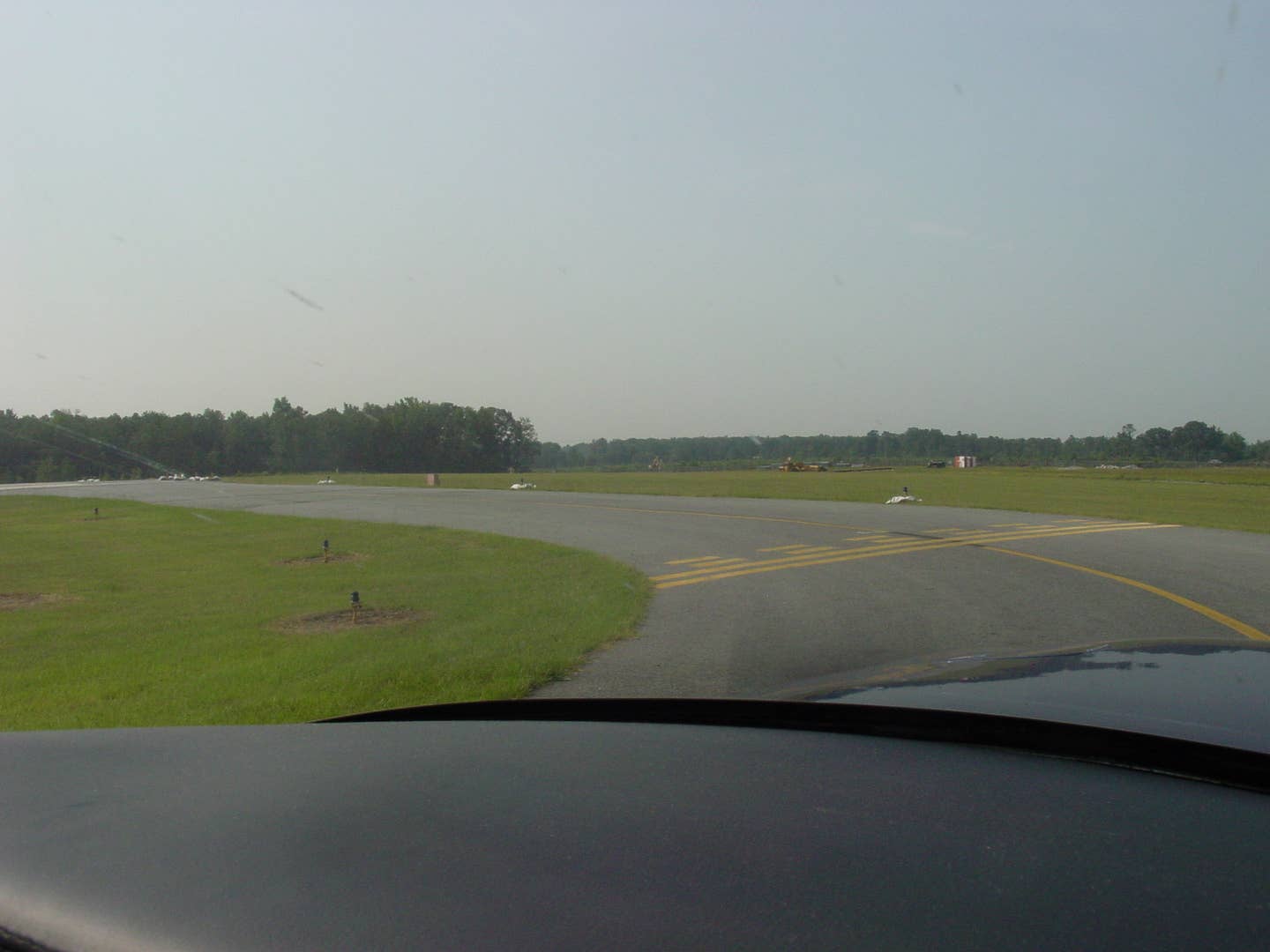
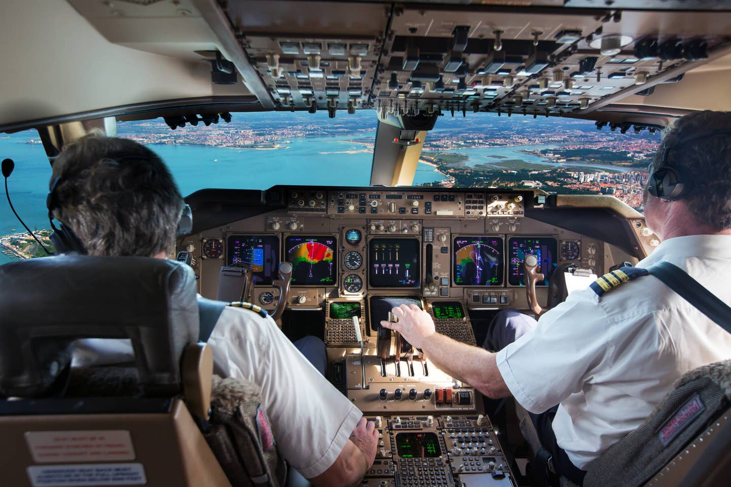
At many airports listening to the one-minute weather will provide the latest altimeter setting, winds, visibility, and sky conditions prior to departure. [Courtesy: Scott Dennstaedt]
Are surface observations based on measurements that are done instantaneously?
Answer: Whether in the form of a METAR or by the ground-to-air radio broadcasts, every pilot uses surface observations to make many routine operational decisions during any particular flight. As we listen to the broadcast prior to taxi, it provides us with an altimeter setting and will likely determine the runway we use for departure.
When approaching an airport under instrument flight rules (IFR), it will help us determine if we’ll be flying a visual approach or need to execute a standard instrument approach procedure. And when Mother Nature is at her worst, it will let us know when we should skip the airport altogether and fly to our alternate destination.
Surface observations are one of those data points that we often take for granted. The truth is that they play a monumental role in many of our most routine decisions. They are not just used by pilots, however, as they also provide air traffic controllers, dispatchers, and weather forecasters with a reasonable depiction of the weather conditions at an airport.
Even with something as ubiquitous as a surface observation, there are some nuances you should understand.
Pilots at all experience levels should be familiar with the two primary automated observing systems deployed at many airports throughout the United States. This includes the Automated Surface Observing System (ASOS) and the Automated Weather Observation System (AWOS). Both of these automated systems consist of a collection of electronic sensors that measure the environment and then process the data to create an observation once every minute.
Sampling the Atmosphere
While many high-impact airports throughout the U.S. still rely on a trained weather observer to construct the routine or special observation (SPECI), automated systems supply them with uniform and objective data for the observation.
However, automated systems measure only the weather that passes directly through the sensor array so it is not able to report what’s happening outside the airport’s runway complex or what is referred to as the airport’s vicinity. Weather observers can certainly augment the observation to add these details.
At airports without a trained observer, pilots must completely rely on the “raw” automated observation. This, however, isn’t as raw as you might think. In order to provide a representative observation, the automated hardware must continuously collect the sensor’s real-time data over a period of time. The automated system applies an algorithm to the collected data to extrapolate the weather to cover a wider area referred to as the terminal area.
When the weather is sampled over a specified period, it will tend to “smooth out” the conditions but also will account for the normal meteorological variations that we see in the weather. Each of the various weather elements shown in the table below identifies the required sample times for its algorithms and provides a summary of where the data are considered valid.
| Parameter | Processing Radius (Miles) | Interval Validity (Minutes) |
| Sky Conditions | 30 | 3-5 |
| Visibility | 10 | 2-3 |
| Precipitation | 10 | 1-2 |
| Freezing Rain | 15 | 2-3 |
| Temp/ Dew Point | 5 | 5 |
| Wind | 2 | 1-2 |
| Pressure | 1 | 5 |
For example, 30 minutes of data provides a fairly reasonable description of sky conditions. This means that the system will detect and process all the clouds (if any) passing over the sensor in the past 30 minutes.
To account for the latest sky conditions, the result is biased by double weighting (counting twice) the last 10 minutes of data. Using the last 30 minutes of data in this way will allow the system to determine the cloud base height and sky coverage included in the surface observation and becomes a reasonable estimate of the sky conditions over a three to 5 sm radius around the location of the sensor (usually sited on the field).

Beware of Rapidly Changing Weather
Even though an ASOS creates a completely new observation every minute, automated systems must have adequate sensor samples to develop an accurate observation. Therefore, in rapidly changing conditions, pilots should expect that most of the weather elements from the automated observations to trend slightly behind the actual weather.
For example, if skies are clear and a sudden broken sky appears on the sensors, ASOS will take only two minutes to report a scattered deck of clouds even though a trained observer may report a broken sky cover. It will take nearly 10 minutes before the observation system will catch up and indicate a broken cloud layer.
This may or may not trigger a SPECI (special observation) for an ASOS (most AWOSs cannot report a special observation). It depends on the height of the broken layer. In other words, a sudden broken ceiling at 600 feet has a significant operational impact and will generate a SPECI since the flight category changed from VFR to IFR. But it will take nearly 10 minutes before the SPECI is issued given the discussion above.
Each minute an ASOS processes the most recent 10 minutes of visibility sensor data to obtain a representative value. Therefore, when visibility drops suddenly (in one minute) from 7 sm to 1 sm, the ASOS needs about four minutes before the 10-minute mean values reach the 3 statute mile criteria. This criterion forces SPECI to alert pilots to a significant change in visibility in this instance. A total of nine minutes will pass before the ASOS will report the 1 sm visibility.
On the other hand, when the visibility rapidly improves from 1 mile to 7 miles, the ASOS generates a SPECI four minutes after reaching the 1.5 sm threshold. In about 11 minutes, the ASOS will report 7 sm. The system is intentionally designed to raise surface visibility more slowly than to lower it. This design provides a margin of safety and buffers rapid changes when the visibility is widely fluctuating over a short period.
Hourly and special observations are the only ones created by human observers. In contrast, ASOS relentlessly measures the weather and could inundate pilots with more frequent special observations than a human observer when the weather is changing rapidly.
Thus, the system is purposely throttled to only provide SPECIs at no more than a five-minute interval to limit the number of observations that can be transmitted during the hour. An even slower response is seen at controlled airports where only the hourly and special observations must be prepared and broadcast on the Airport Terminal Information System (ATIS). At uncontrolled airports pilots can also receive the one-minute weather by calling the voice phone link or by the ground-to-air radio broadcasts.
The FAA has created a Google map presentation online showing the locations of all automated weather systems across the country, which may be found here. This includes the frequency and phone numbers for each ASOS and AWOS currently in operation.
Lockout Period
If you pay attention to the issuance time on METARs, you will notice that many are issued a few minutes before the top of each hour. This allows the observation to be transmitted and ingested into other computer systems such as numerical weather prediction models.
Some models get executed at the top of the hour or shortly thereafter. Starting at 47:20 past the hour, the ASOS begins to make its routine observation. By 53:20, the hourly observation has been prepared and edited and should be ready for transmission.
This period of time between 47:20 and 53:20 minutes after the hour is known as the lockout period. During this time, the ASOS is prevented from issuing any other reports, including SPECIs. The ASOS still continuously monitors and records the weather during the lockout period.
However, it just can’t issue a formal surface observation. This does not affect the one-minute weather you receive by calling the voice phone link or by the ground-to-air radio broadcasts, but it will affect any formal observations that are transmitted that you may see on your datalink weather broadcast.
Can I Trust Automated Observations?
All observations, whether automated or taken by human observers, should be used with care.
Pilots must be aware of how long ago the observation was taken, under what conditions, and whether or not they are special observations. Even though automated systems are totally objective and maintain a certain uniformity among all sites, it does not mean they match what a pilot sees out the windscreen.
ASOS may occasionally report cloud decks lower than what is actually encountered. Sometimes precipitation, lower cloud fragments, or fog triggers these lower values. Pilots have said that these “lower” reported values often indicated the height below which they had to fly before gaining enough forward visibility to see an airport and land.
The key lesson here is to evaluate all reports closely before dismissing them as inaccurate.
Even though the visibility sensor is designed to objectively represent the visibility of the atmosphere over a wide range of weather conditions, day or night, it occasionally reports a visibility more optimistic than what a human perceives.
During the day, the human eye can be overwhelmed by bright light reflected in clouds, light precipitation, fog, or haze. Many pilots will resort to wearing sunglasses to obtain some relief from the glare.
The ASOS visibility sensor is not as sensitive to this condition and sometimes reports a visibility approximately twice as high as what an individual may determine. Be alert for these bright conditions and expect a more optimistic value from the automated system.

What Will Automation Not Provide?
We can easily become complacent when it comes to automation. We learn to trust automation and sometimes don’t acknowledge that it has real limitations.
Therefore, to finish this discussion, it is just as important to know what automation will not provide.
Automation systems can only report the weather that passes through the sensor array. They do not provide a horizon-to-horizon evaluation of the weather. This means that weather in the vicinity of the airport will not be measured. A rain shower that passes just to north of the airport, for instance, may reduce visibility in that immediate area but will not be reported by the automated system.
Next, the ASOS only reports clouds that are below 12,000 feet. This means that an overcast cloud deck at 14,000 feet will be reported as clear. Effectively, a clear sky report from an automated station means clear below 12,000 feet.
For airports with a human observer, this report can be augmented to include clouds above 12,000 feet. Some of the new AWOSs being installed can automatically report clouds above 12,000 feet up to and including 30,000 feet.

Automated systems can only report one precipitation type at a time. For instance, if freezing rain and snow are detected, snow is reported. Certainly, weather observers can edit the observation before transmission to include additional precipitation types.
Lastly, the ASOS is not designed to report virga, tornadoes, funnel clouds, ice crystals, snow pellets, ice pellets, drizzle, freezing drizzle, and blowing obstructions such as dust or sand. All of these elements can be provided at locations that employ a trained observer. Often with drizzle, freezing drizzle, ice pellets, or a mixture, you will see the automated system report an unknown precipitation type (UP).
Nevertheless, automated reporting is in its infancy, so it’s likely new sensors will be added to measure some of these other weather elements in the future.

Sign-up for newsletters & special offers!
Get the latest FLYING stories & special offers delivered directly to your inbox