Is Sferics Equipment Still Needed in the Cockpit?
It depends on the mission and how much money you’re willing to spend.
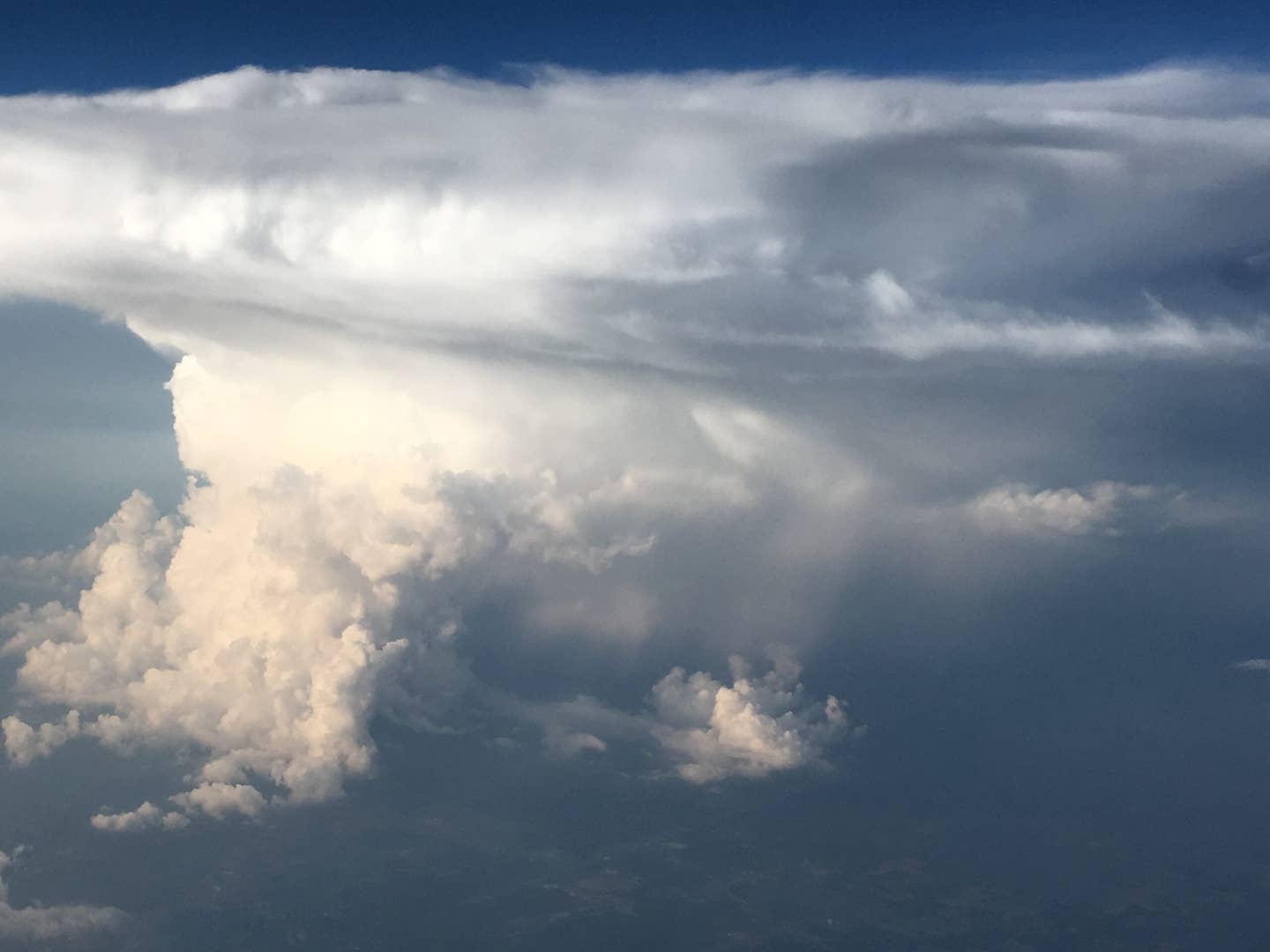
[Courtesy: Scott Dennstaedt]
Question: Now that ground-based lightning has made its way into our cockpits, is there still a need for a sferics device such as a Stormscope?
Answer: It depends on your mission and how many Ben Franklins you have to spare. Your sferics (short for radio atmospherics) equipment may represent the only real-time weather you’ll ever see in your cockpit.
Sure, panel-mounted and portable weather systems deliver their product in a timely fashion, but it will never be as immediate as your sferics device. Once you understand how to interpret your real-time lightning guidance, it can become a valuable asset in your in-flight aviation toolkit.
Choices in the Cockpit
You have two options if you want lightning data in the cockpit: You can choose from ground-based lightning sensors or onboard lightning detection from a sferics device such as a Stormscope.
A Stormscope provides real-time data but does require some basic interpretation. Ground-based lightning, on the other hand, is a bit delayed and is only available through a data link broadcast at this time. Ground-based lightning is normally coupled with other weather guidance, such as ground-based weather radar (NEXRAD), surface observations, pilot weather reports, and other forecasts.
Ground-Based Lightning
The ground-based lightning that’s now available through the Flight Information System-Broadcast (FIS-B) comes from the National Lightning Detection Network (NLDN). This network of lightning detectors has a margin of error of 150 meters for locating a cloud-to-ground strike. The ground-based lightning sensors instantly detect the electromagnetic signals given off when lightning strikes the earth's surface.
With 150-meter accuracy, I’d choose ground-based lightning any day. Don’t get too excited, though. Ground-based lightning is expensive (the data is owned by private companies like Vaisala), and you’ll not likely see a high-resolution product in your cockpit anytime soon.
SiriusXM satellite weather pulls from a different lightning detection network and includes both cloud-to-ground and intracloud lightning. It produces a 0.5 nm horizontal resolution lightning product. This means that you will see a lightning bolt or other symbol arranged on your display in a 0.5 nm grid.
Even if 50 strikes were detected minutes apart near a grid point, only one symbol will be displayed for that grid point. Same is true for the FIS-B lightning.

Stormscope Advantages
A Stormscope must be viewed as a gross vectoring aid. You cannot expect to use it like onboard radar.
Nevertheless, it does alert you to thunderstorm activity and will provide you with the ability to see the truly ugly parts of a thunderstorm. Where there’s lightning, you can also guarantee moderate or greater turbulence.
No lightning detection equipment shows every strike, but the Stormscope will show most cloud-to-ground and intracloud strikes. This allows you to see the intensity and concentration of the strikes within a cell or line of cells with a refresh rate of two seconds. It also lets you see intracloud electrical activity that may be present in towering cumulus clouds even when no rain may be falling.
Even if no cloud-to-ground strikes are present, intracloud strikes may be present. The Stormscope can detect any strike that has some vertical component (most strikes do). This is important since there are typically more intracloud strikes than cloud-to-ground strikes.
To emphasize this point, most of the storms in the Central Plains have 10 times more intracloud strikes than cloud-to-ground strikes. Moreover, during the initial development of a thunderstorm, and in some severe storms, intracloud lightning may dominate the spectrum.
Also keep in mind that a sferics device does not suffer from attenuation like onboard radar. That is, it can “see” the storm behind the storm to paint cells in the distance out to 200 nm, but it does not see precipitation or clouds.
Stormscope Disadvantages
It doesn’t take a full-fledged storm, complete with lightning, to get your attention.
Intense precipitation alone is a good indicator of a strong updraft (or downdraft) and the potential for moderate to severe turbulence in the cloud. Consequently, the Stormscope does not tell you anything about the presence or intensity of precipitation or the absence of turbulence.
Never use the Stormscope as a tactical device to penetrate a line of thunderstorm cells. Visible gaps in the cells depicted on the Stormscope may fill in rapidly. Fly high and always stay visual and you will normally stay out of any serious turbulence.
A Stormscope display is often difficult to interpret by a novice. Radial spread, splattering, buried cables, and seemingly random “clear air” strikes can create a challenge for the pilot. It may take a couple years of experience to be completely comfortable interpreting the Stormscope display. Often what you see out of your window will confirm what you see on your display.
Radial Spread
As the name suggests, the biggest Stormscope error is the distance calculation along the radial from the aircraft.
The placement of the strike azimuthally is pretty accurate. However, how far to place the strike from the aircraft along the detected radial is a bit more complicated and prone to error.
Lightning strikes are not all made equally. When the sferics devices were invented back in the mid-1970s, they measured the distance of the cloud-to-ground strike based on the strength of the signal (amperage) generated by the strike. An average strike signature of 19,000 amperes is used to determine the approximate distance of the strike.
Statistically, 98 percent of the return strokes have a peak current between 7,000 and 28,000 amperes. That creates the potential for error in the distance calculation. This error is a useful approximation, however, in that strokes of stronger intensity appear closer and strokes of weaker intensity appear farther away.


In strike mode on the Stormscope, strikes are displayed based on a specific strike signature, whereas cell mode on the newer Stormscope models uses a clustering algorithm that attempts to organize these strikes around a single location or cell.
Cell mode will even remove strikes that are not part of a mature cell. Most thunderstorm outbreaks are a result of a line of storms. Cell mode provides a more accurate representation to the extent of the line of thunderstorms.
Radial spread is not necessarily always a bad thing. You can use it to your advantage to distinguish between false or clear air strikes and a real thunderstorm. Most of the strikes of a real storm will be of the typical strike signature and be placed appropriately.
As mentioned above, stronger than average strikes will be painted closer to the airplane. Looking at this in strike mode, a line of these stronger strikes will protrude toward the aircraft. The result is a stingray-looking appearance to the strikes.
You can confirm this by clearing the display. The same stingray pattern should reappear with the tail protruding once again toward the airplane.
Clear Frequently
Clearing the Stormscope display frequently is a must. How quickly the display “snaps back” will provide you with an indication of the intensity of the storm or line of storms.
You should be sure to give these storms an extra-wide berth. Clearing the Stormscope in “clear air” will also remove any false strikes that may be displayed allowing you to focus on real cells that may be building in the distance.

Aging
Both ground-based and onboard lightning use a specific symbol to indicate the age of the data.
For Stormscope data shown on the Garmin 430/530, a lightning symbol is displayed for the most recent strikes (first six seconds the symbol is bolded). The symbol changes to a large plus sign after one minute followed by a small plus sign for strikes that are at least two minutes old. Finally, it is removed from the display after the strike is three minutes old.
Cells with lots of recent strikes will often contain the most severe updrafts and may not have much of a ground-based radar signature. Cells with lots of older strikes signify steady-state rainfall reaching the surface that may include significant downdrafts.
Flight Strategy
A nice feature of a Stormscope is that you can quickly assess the convective picture out to 200 nm while still safely on the ground. Same is true for lightning received from the SiriusXM datalink broadcast.
However, for those with lightning from FIS-B, you won’t receive a broadcast until you are well above traffic pattern altitude unless your departure airport has an ADS-B tower on the field.
As soon as your Stormscope is turned on, within a few minutes you’ll get a pretty good picture of the challenging weather ahead. If you are flying IFR, you may want to negotiate your clearance or initial headings with ATC to steer clear of the areas you are painting on your display. I’ve canceled or delayed a few flights based strictly on the initial Stormscope picture while I was still on the ramp.
Another goal is to fly as high as allowable. You will benefit from being able to get above the haze layer, and the higher altitude will allow you to see the larger buildups and towering cumulus from a greater distance.
If you are flying IFR and you are continually asking for more than 30 degrees of heading change to get around small cells or significant buildups, then you should call it quits. You are too close, or you are making decisions too late.
Visual or not, the goal is to keep the strikes (in cell mode) out of the 25-mile-range ring on your Stormscope. If one or two strikes pop into this area, don’t worry. Just keep most of the strikes outside of this 25-mile ring.
Don’t discount the value of a sferics device. Add one of the data link cockpit weather solutions as a compliment, and you will have a great set of tools to steer clear of convective weather all year long.


Sign-up for newsletters & special offers!
Get the latest FLYING stories & special offers delivered directly to your inbox