Peruvian Excursion Provides a Lesson in High Vapor Pressure
What is going to the airplane engine is more like froth than fuel.
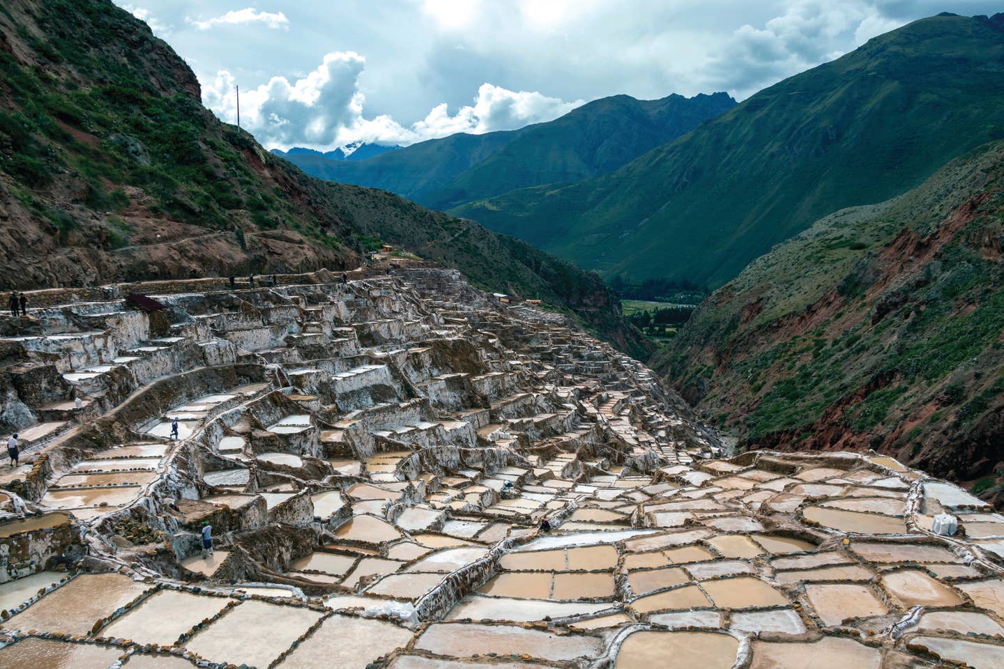
Salina de Maras, the traditional Inca salt field in Maras near Cuzco in Sacred Valley, Peru. [Adobe Stock]
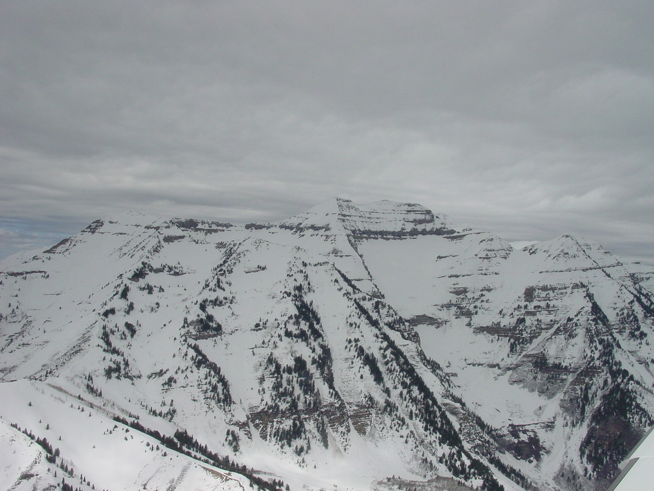
Lima, Peru, is overcast, as usual. We try to cancel IFR and turn on course once we’re on top, but the controllers insist on keeping us with them until Salinas, 40 miles down the coast. We finally cross Salinas at 12,000 feet and swing around northeastward. The Andes are close, rearing out of the stratus deck into a cloudless sky.
At 15,000 feet I notice that the fuel pressure is fluctuating. I watch the gauge intently. The tempo of the engine is unsteady. The fluctuations become larger and longer.
If you're not already a subscriber, what are you waiting for? Subscribe today to get the issue as soon as it is released in either Print or Digital formats.
Subscribe Now
The fuel selector valve and feed lines are under a floorboard beneath Nancy’s feet. I nudge her legs aside and remove the floorboard. I can see the fuel in the plastic lines on its way to and from the engine. Normally the flow to the engine is invisible, while the vapor return is full of bubbles. Now both lines are full of bubbles. What is going to the engine is more like froth than fuel. I switch tanks, and a moment later the engine goes silent. Boost pump—it roars back, hunts for a moment, then settles back to an unsteady rumble. Nancy has lifted her hands to her face in an instinctive gesture of fright. The mountains are close below us.
- READ MORE: The Craft of Providing Variety in Airplanes
What’s wrong? Has a fuel line sprung a leak? But how can the lines from both tanks have gone leaky at once? Suddenly I recall being told that paper fuel filters could get clogged without appearing to be excessively dirty. They would gradually choke off the fuel supply, and the telltale sign would be a drop in fuel pressure. There are paper filters in the feed lines from both tanks. That must be it: Some impurity in the fuel has increased the resistance of the filters, and the engine-driven pump is pulling against the resistance, forming vapor.
Reluctantly, I turn back, call Lima Approach, and report an engine problem. It clears us direct, and we make the ILS approach. Below 10,000 feet the problem disappears, and I feel chagrin at having turned back.
On the ground, I check the fuel system. No leaks. I inspect the filter elements. They contain some lint and metal chips, mementos of the backyard construction of the wet wings, but do not appear excessively dirty. I discard them anyway, leaving the filter shells empty.
After two hours we’re back in the air. Now we’re both watching the fuel pressure. Above 10,000 feet it begins to fluctuate and gets steadily worse as we climb. There has been no improvement. But there is also nothing I can do that I have not already done. We level out at 19,000 feet.
In the hours we’ve wasted, clouds have built up over the mountains, but they are conveniently placed on either side of our route, as is often the case, because the clouds form first over the peaks while the routes follow the passes. We pass the beacons of Oyon—a small town nestled in a valley on our left—and Huanuco. The mountains fall away. Clouds are building on the eastern slope. We turn gradually toward the north over Tingo Maria and Tarapoto. Our last radio contact is with Tarapoto: shouting and static, thanks, goodbye.
- READ MORE: Looking at the Physics of STOL Drag
The mountains behind us, we descend to 12,000 feet. The fuel pressure is a little steadier here, but its misbehavior has left me with a lingering distrust. We are over the headwaters of the Amazon River. I take a heading from the chart, which is now a blank interrupted only by an occasional blue line of latitude. Half an hour later, a huge, sinuous serpent of a river comes into view. It is the Marañon, but I cannot tell where along it we are.
It will be hundreds of miles before we encounter another positive landmark. Ahead of us the sky is creamy and, close to the horizon, ominously dark. I feel the quiet, suspended unease that sometimes comes upon me over ocean or forest, or in darkness over mountains in this homemade single-engine plane.
There is nothing to do but hold heading and wait. Time creeps by. The fuel tanks switch automatically every few minutes. The trees, which I can discern only with difficulty through 3 kilometers of haze, look low and flat in their billions, a dense blue-green canopy under which brilliant parrots shriek; myopic anteaters nose among rotten logs in solitary shafts of sunlight; monkeys pick lice from one another; jaguars sleep; giant blue butterflies fan their wings slowly on dripping vines; and snakes doze draped over smooth limbs.
Perhaps the drone of our engine momentarily diverts the attention of a naked bowman. I know it’s all there. I’ve seen it in the movies. The sun disappears behind an anvil head. Soon we plunge into a wall of clouds. Rain showers clatter against the windshield. We break out, glimpse an anonymous river—is it the Urituyaco, Copalyacu, Corrientes, Tigre, Curaray or Tiputini?—and then collide with a new mountain of clouds.
In principle, we are heading almost due north and crossing a degree of latitude every 23 minutes. Each 23 minutes, therefore, I mark an estimated point on the folded chart. I suspect we may have drifted into Ecuador, but from our position the difference between Peru, where we are authorized to be, and Ecuador, where we are not, seems insignificant. We cross a big river full of silty islands: It must be the Rio Napo. We should be picking up the beacon at Tiputini, but we are not.
- READ MORE: There’s Something Essential in the Bank
A little later the ADF suddenly wakes up and points to Limoncocha in Ecuador. A moment later it finds Tarapoa, then Puerto Asis, and I am finally able to triangulate our position: on the equator, near 76 degrees west longitude. Then, on the right, an airstrip, settlement, river fork, island. Completely unsought and unexpected, the landmark offers itself with a helpful generosity that is as touching in inanimate objects as it is in strangers. It is Putumayo. We have entered Colombia.
The sun is setting as we cross the eastern cordillera. It briefly illuminates a sublime vista of cloud, cliff, valley, and river that deserves a double-page spread in a coffee-table book of Colombian landscape. We are making a good ground speed: 180 knots. Florencia passes beneath us, Neiva, and Girardot. Chocolate pours down from the mountains as we make the long straight-in approach to Bogotá.
A few days later, at the airport, I chat with a local pilot who is there, like me, to wrestle with the bureaucratic serpent of flight authorizations. I tell him about the fuel pressure problems I had on the way from Lima.
“Oh, yeah,” he says. “High vapor pressure. As soon as I get up into the mountains, I just turn on the boost pump and leave it on. The fuel here is crap.”
This column first appeared in the July/August Issue 949 of the FLYING print edition.


Sign-up for newsletters & special offers!
Get the latest FLYING stories & special offers delivered directly to your inbox