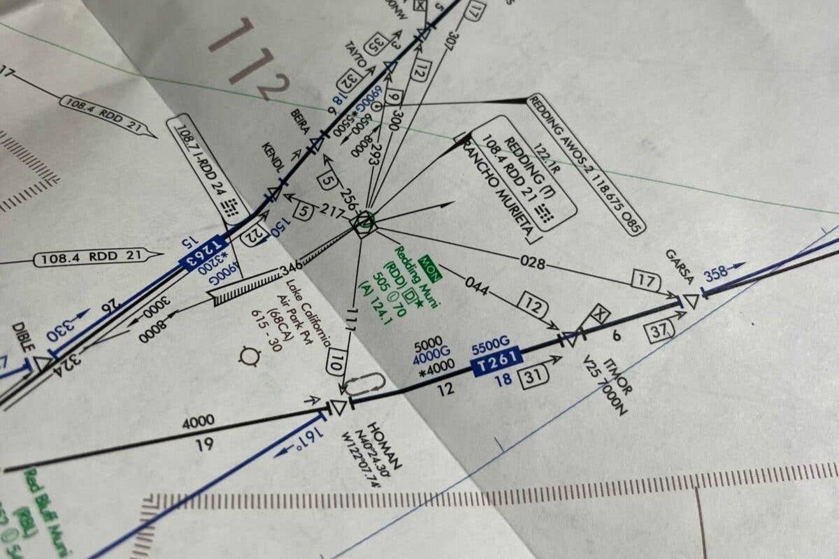
Revisiting chart symbology, approach plates and procedures will enable even the rustiest pilots to regain confidence and proficiency.
[Courtesy: Meg Godlewski | FLYING magazine]
Even the rustiest of pilots—and especially those who hold an instrument rating—should remember and understand the basic ideas behind two of the major sets of rules that govern how we fly.
Visual flight rules (VFR) require that pilots maintain visual contact with the ground at all times during flight, which primarily means that flying VFR requires us to keep our distance from the clouds. Instrument flight rules (IFR), however, enable us to endeavor on flights into instrument meteorological conditions (IMC), including flight through clouds and fog, or even on particularly dark nights when the ground and sky are indistinguishable.
Pilots who do not use their IFR skills often will find that maintaining proficiency is challenging. Dusting off an unused instrument rating can feel like returning to IFR training all over again. Indeed, much of the good advice for those in instrument training still applies for rusty instrument pilots.
Aside from instrument-specific radio communications, relearning to read the various IFR charts and plates is often the biggest hurdle for those looking to return to IMC safely. IFR charts and related procedures are quite dissimilar to VFR charts and VFR navigation, and proper interpretation and execution are not likely to come intuitively to those who mostly fly VFR.
Without regular practice, skills can deteriorate, and a pilot’s confidence and ability to stay ahead of the airplane will inevitably diminish.
Understanding IFR Charts
Regardless of the visibility conditions, IFR charts are the maps we use for safely navigating the skies while on an IFR flight plan. We rely on them to fly in an orderly, predictable, and standardized way. Flying this way greatly simplifies things both for ourselves and for others as we work together with ATC to navigate efficiently while keeping our distance from other traffic.
Important IFR publications we’ll utilize prior to our approach to landing include En Route Charts, Standard Terminal Arrival Routes (STARs), and Standard Instrument Departures (SIDs).
Types of IFR charts
En Route Charts are what we use for the bulk of IFR navigation and help pilots find their way through the cruise portion of flight. These charts are available in low-altitude and high-altitude versions. Low-altitude charts depict airways utilized by aircraft flying below 18,000 feet msl, while high-altitude charts are intended for aircraft cruising above that altitude.
These charts display important navigation information, including navigational aids (navaids), airways, fixes, and relevant radio frequencies along with minimum en route altitudes (MEAs) and other data points relevant to safe IFR navigation. Worth mentioning also are Area Charts, a type of low en route chart that depicts particularly busy terminal areas at a larger scale.
Standard Terminal Arrival Routes (STARs) are generally, though not always, geared toward jets and turboprops. Regardless, these are designed to help aircraft transition from en route flight into the terminal area. One could liken these routes to a highway off-ramp, designed to safely transition cars from highway speeds down to the slower, often more crowded city environment.
IFR Tools For Pilots
STARs are published in Terminal Procedures Publications (TPP) and provide a series of fixes and headings, along with standardized speed and altitude restrictions, meant to simplify and streamline the flow of traffic in busy airspace. This makes life easier for pilots, other aircraft, and controllers alike.
Standard Instrument Departures (SIDs) are similar to STARs but are for departure routes instead of arrival routes. Similarly to the way a STAR integrates pilots into the terminal environment from the en route phase of flight, SIDs provide pilots with standardized routes that integrate them safely into the en-route environment. They are the “on-ramp” into the en route environment.
Like STARs, SIDs may include altitude and speed restrictions and provide specific headings and fixes that form routes pilots are to follow.
Chart symbols and legends
Of course, charts and route documents are only helpful if you know how to read them, and pilots who fly primarily VFR will find that familiarity with VFR charts does not necessarily transfer to IFR charts. The layout, symbols, and notations of IFR charts can be overwhelming, especially for pilots who haven’t used them in a while.
Key symbols to be aware of include:
- Navaids: These are represented by shapes such as hexagons for VORs or squares for NDBs. Symbology and notations around those symbols will provide information about appropriate frequencies, service coverage, and Morse code identifiers, where applicable.
- Fixes: Essentially GPS waypoints, small symbols usually represented as triangles or dots mark critical locations along flight routes.
- Airways: Airways are typically represented lines connecting navaids or fixes. These lines are annotated with information such as minimum en route altitudes (MEAs) and distances, ensuring safe and efficient routing between different sections of the flight.
Legends and notes included with and on IFR charts can help you decipher these symbols and other relevant notations. Even so, spend time well before flying brushing up on symbology and the like. The time for review is not while en route. This is perhaps the quickest way to fall behind your airplane and to put yourself, your passengers, and your aircraft at risk.
Take the time to review all the symbols, notations, and other pertinent information shown on charts you will use for routes during your planning. Familiarize yourself also with potential alternate routes. The last thing you want during an emergency, diversion, or otherwise real-time altered route is to be looking at unfamiliar symbols or instructions for the very first time.
Reading procedures and minimums
Instrument approach procedures, which provide instructions for pilots to make their approach to landing in instrument meteorological conditions (IMC), are detailed in approach plates.
Approach types include precision ILS, nonprecision VOR or LOC, or an APV such as RNAV (GPS) with LPV. Each approach plate provides critical information required to make a safe and accurate approach.
Plates will include an overhead and side-view depiction of the approach path, altitude restrictions, navigation frequencies, and minimum descent altitudes or decision heights, below which pilots must be able to see the runway.
Important elements of an approach plate include the plan view, depicting the horizontal layout of the procedure, along with a profile view, which displays vertical guidance. Missed approach instructions, airport diagrams, and notes on lighting systems and nearby terrain are also included.
Although pilots should review these charts during flight, you should already be familiar with them well before takeoff. Spend time during planning to ensure approach plates for your planned destination, as well as those for any and all alternates are thoroughly understood to avoid any surprises during your approach.
Practical Tips for Chart Review
Effective study techniques
While every pilot should review the various charts and plates they will use prior to any given flight, it may be the case that you need to relearn how to use them more or less from scratch before thinking about trying to use them to plan a real flight.
The best place to start is with FAA resources such as the Instrument Flying Handbook and the Instrument Procedures Handbook. Look also to legends included with many IFR publications. As you work through these, consider techniques such as quizzing yourself on specific chart symbols or procedural elements using flash cards, for example.
While these are some of the best primary resources, they can be dense and can be a lot to digest. Additional resources that may help make things more “bite sized” and easier to understand include online courses like those offered by Sporty’s Pilot Shop, as well as third-party study guides such as Rod Machado’s Instrument Pilot’s Handbook, for example.
Flight simulators can also be quite helpful tools for practicing and reinforcing your knowledge.
Flight simulators like X-Plane and Microsoft Flight Simulator offer practical ways for pilots to practice putting chart interpretation and navigation skills to the test without the pressure and costs of actual flights. Likewise, digital platforms like ForeFlight and SkyVector provide interactive charts that allow pilots to plan routes, explore airways, and refine their flight planning techniques.
Focusing on key areas
Because IFR charts contain huge amounts of information, it’s important to focus on what is most relevant to your flight operations. Take time to review en route charts, including airway layouts, MEAs (Minimum Enroute Altitudes), and navigation aids.
Understanding these ensures you can safely navigate between fixes while maintaining obstacle clearance and communication with ATC. Pay close attention to how routes and intersections connect, as quick mental visualization of these can improve situational awareness.
On approach plates, focus on important details such as minimum altitudes and stepdowns, navigation frequencies, and missed approach procedures. Understanding how to quickly identify the plan and profile views, plan for descents, and reliably identify minimums and decision points builds confidence during approaches.
Reviewing symbols and decoding chart legends can sharpen situational awareness. Targeted and repeated practice through consistently reading and interpreting a wide variety of IFR charts and plates builds familiarity with IFR procedures and mitigates later real-time risks.
Real-world application
Home flight simulators, larger scale ATD simulators, and other digital tools offer valuable opportunities to apply IFR chart knowledge.
Using a simulator to practice flying specific STARs, SIDs, and approaches can significantly build a pilot’s confidence and competence. In addition to technical skills, these simulators also improve decision-making and procedural flow, which are critical when flying IFR.
Another way to gain more proficiency is to review IFR charts before each flight, even if the flight is VFR. Although you may not actually conduct an IFR flight, doing so will help build familiarity with the charts and will provide better situational awareness of nearby airways, navaids, and transition routes.
Aside from providing some good practice, making a habit of doing this sort of review can also make it easier to transition smoothly to IFR in the event weather conditions deteriorate unexpectedly.
Staying current with changes
IFR charts are regularly updated to stay current with any and all changes in airspace, navaids, procedures, and other factors that are relevant to safe flight. Pilots need to keep their charts current, both in the interest of best practice and in order to fly legally under IFR.
Reviewing Notices to Air Missions (NOTAMs) and Temporary Flight Restrictions (TFRs) should likewise be part of every preflight planning session, regardless of whether the flight is IFR or VFR. Digital tools that alert pilots to chart revisions, such as those offered by EFBs like ForeFlight, are also quite useful tools for pilots to ensure they are always utilizing up-to-date tools and information.
Instrument-rated pilots need to know their IFR charts if they are to exercise their privileges in IMC. These tools demand regular, ongoing review and practice in order to be used safely and effectively.
Revisiting chart symbology, approach plates and procedures, and regularly practicing instrument flight techniques in simulators and beyond will enable even the rustiest pilots to regain confidence and proficiency.
If you are still feeling rusty and looking to get back up to date, check out this next article on preflight inspections.
FAQ
How often are IFR charts revised?
IFR charts are revised every 56 days to incorporate updates to airspace, routes, and navigation aids. Pilots must also review NOTAMs for interim changes.
How often are instrument approaches updated?
Instrument approach procedures are updated on the same 56-day cycle as IFR charts. This ensures pilots have accurate and current data for safe and compliant operations.
What is the 1-2-3 rule for IFR?
Pilots use the 1-2-3 rule to help them figure out if they need to include an alternate airport aside from their destination in their IFR flight plan. While there are some additional factors to consider, generally if the forecast at the destination shows to expect ceilings below 2,000 feet agl or that the visibility will be less than 3 sm within the hour before or after the planned arrival time, an alternate is legally required.
Can you fly IFR with an expired nav database?
You can fly IFR with an expired navigation database if you are not relying on GPS for navigation or approaches, such as when using ground-based navigation aids like VORs. However, RNAV (GPS) approaches cannot be conducted with an expired database, and you must always carry current charts to verify waypoints and procedures for legal and safe operation.

Sign-up for newsletters & special offers!
Get the latest FLYING stories & special offers delivered directly to your inbox


