‘Hurricane Hunters’ Fly Into the Eye of Hurricane Milton
Pilots with the National Oceanic and Atmospheric Administration’s Aircraft Operations Center study the storm as it approaches Florida.
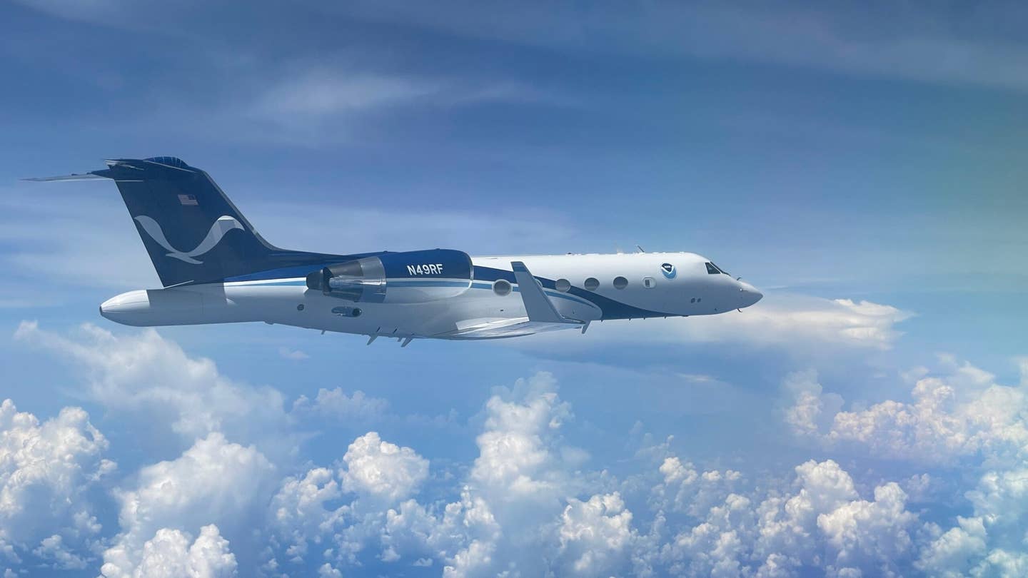
The National Oceanic and Atmospheric Administration uses a fleet of hurricane hunters, including this Gulfstream IV-SP nicknamed ‘Gonzo’ to study developing storms. [Courtesy: Nick Underwood/NOAA]
As Hurricane Milton barrels toward the west coast of Florida packing 155 mph winds, pilots are flying into the belly of the beast.
The National Oceanic and Atmospheric Administration’s (NOAA) Aircraft Operations Center (AOC) houses a small fleet of “hurricane hunters,” which researchers deploy to predict a hurricane’s structure, intensity, and path. And with Milton forecast to remain a major hurricane when it impacts the Tampa area on Wednesday, the data they gather will be as important as ever.
“This data will then be sent to the National Hurricane Center (NHC) and into the weather models to help us pinpoint this track forecast,” said Sofia de Solo, a NOAA flight director, in a preflight brief, “which is extra important this time around, being that the hurricane is expected to hit in a highly populous and highly vulnerable region that just got hit by Hurricane Helene.”
For more than four decades, NOAA’s AOC has managed and maintained ten crewed aircraft at Lakeland Linder International Airport (KLAL) in Florida. Among them are the hurricane hunters: a pair of Lockheed WP-3Ds, or P-3s, affectionately dubbed "Kermit" and "Miss Piggy", and a Gulfstream IV-SP nicknamed "Gonzo."

"Kermit" and "Miss Piggy" are designed to fly directly into hurricanes. The four-engine turboprops handle both storm research and reconnaissance when called upon by the NHC, measuring storm structure and intensity, producing real-time forecasts, and scanning for indicators of deadly storm surges. These missions typically take the P-3s into the eye of the storm to measure its central pressure.
"Gonzo," meanwhile, flies above and around hurricanes with its range of about 4,000 nm and cruise altitude of 45,000 feet. NOAA uses the G-IV to study weather systems in the upper atmosphere surrounding a storm, which can help predict its path. According to the agency, it has flown around nearly every Atlantic-based hurricane that has posed a threat to Americans since 1997.
Outside hurricane season, the aircraft are also used to study weather phenomena such as the El Niño system, atmospheric gases over the North Atlantic, and winter storms on the U.S. Pacific coast.

"Miss Piggy" so far has made two flights into Milton, passing through the eye of the storm multiple times in what NOAA calls a “butterfly pattern,” used to identify the center of a hurricane.
“Essentially, every time we pass through the center, we’re going to get a look at the structure of the storm,” said Jonathan Zawislak, a NOAA flight director.
During each pass, the P-3 released dropsondes, which NOAA describes as “weather balloons in reverse.” These expendable devices float on the ocean surface and collect temperature, dew point, wind speed, and pressure data, which can help researchers predict intensity and pathing. The aircraft also produced 3D imagery of Milton using its tail doppler radar.
"Gonzo" so far has flown three missions to collect readings on the air and water in front of Milton, which can “steer” the storm. The G-IV also released dropsondes and gathered tail doppler radar data, beaming it back to the NHC.
“On satellite imagery, the storm presents itself very small. It has a very small pinhole, and due to the intensification, the storm is evacuating air at a very rapid rate,” said de Solo during the preflight briefing. “Up at where we’re flying at 40,000 feet, we’ll feel that.”

NOAA hurricane hunters use tail doppler radar to create 3D imagery of storms, such as this map of Hurricane Sam from September 2021. [Courtesy: NOAA]
According to NOAA, similar missions will be flown before Milton makes landfall. On Tuesday, hurricane-force winds and a life-threatening storm surge are expected across the north coast of the Yucatan Peninsula. The hurricane will remain “extremely dangerous,” NOAA and the NHC said Tuesday morning, and could produce an “extremely life-threatening situation” along Florida’s west coast, where a hurricane warning is in place.
“Preparations to protect life and property in the warning areas should be complete by tonight,” the agencies said in an update on X.
NOAA also intends to deploy uncrewed aircraft systems (UAS) to assist its hurricane hunters. The agency owns two such systems, the Altius 600 and Blackswift S0, that measure temperature, pressure, wind, and humidity both for storms and the ocean surrounding them. Both aircraft are deployed from the P-3 and piloted remotely, capable of staying aloft for up to four hours.
Aircrews eject the drones from beneath the aircraft at about 220 knots, transporting them as close as possible to the eye of the storm. Data is beamed directly from the UAS back to the P-3, which then sends it to the NHC. The drones are capable of going places crewed aircraft cannot, particularly near the ocean’s surface.
As Hurricane Helene approached the U.S. Southeast, "Miss Piggy" and "Kermit" deployed several Blackswifts to study its composition and path. NOAA told FLYING the agency will fly similar UAS for similar missions as Milton grows closer.
NOAA and the NHC encouraged the public to pay attention to the latest Milton updates on the NHC's website, noting that forecasts are constantly shifting.
Some NOAA hurricane hunter missions are supported by the 53rd Weather Reconnaissance Squadron, also known as the Air Force Reserve Hurricane Hunters. Stationed at Keesler Air Force Base (KBIX) in Biloxi, Mississippi, the 53rd deploys a WC-130J Super Hercules to survey storms in the Atlantic, Pacific, Caribbean, and Gulf of Mexico for the NHC.
A spokesperson for the Hurricane Hunters told FLYING the squadron flew three missions apiece on Sunday and Monday, with two more scheduled for Tuesday. It flew nine reconnaissance missions into Hurricane Helene last month.
Like this story? We think you'll also like the Future of FLYING newsletter sent every Thursday afternoon. Sign up now.


Sign-up for newsletters & special offers!
Get the latest FLYING stories & special offers delivered directly to your inbox