Last summer, my wife and I wanted to visit the Brooks Range in August to hunt Dall sheep. For those not familiar with it, the Brooks Range is a mountain range stretching about 700 miles from western Alaska across the state east to Canada’s Yukon Territory. From where we live in South Central Alaska, it is more than 600 nautical miles north of us, and just getting there, in a light airplane across central Alaska’s mountainous terrain, can at times be challenging. The month almost got away from us, but we finally saw a promising weather window in the last week of August.
Dawn Departure
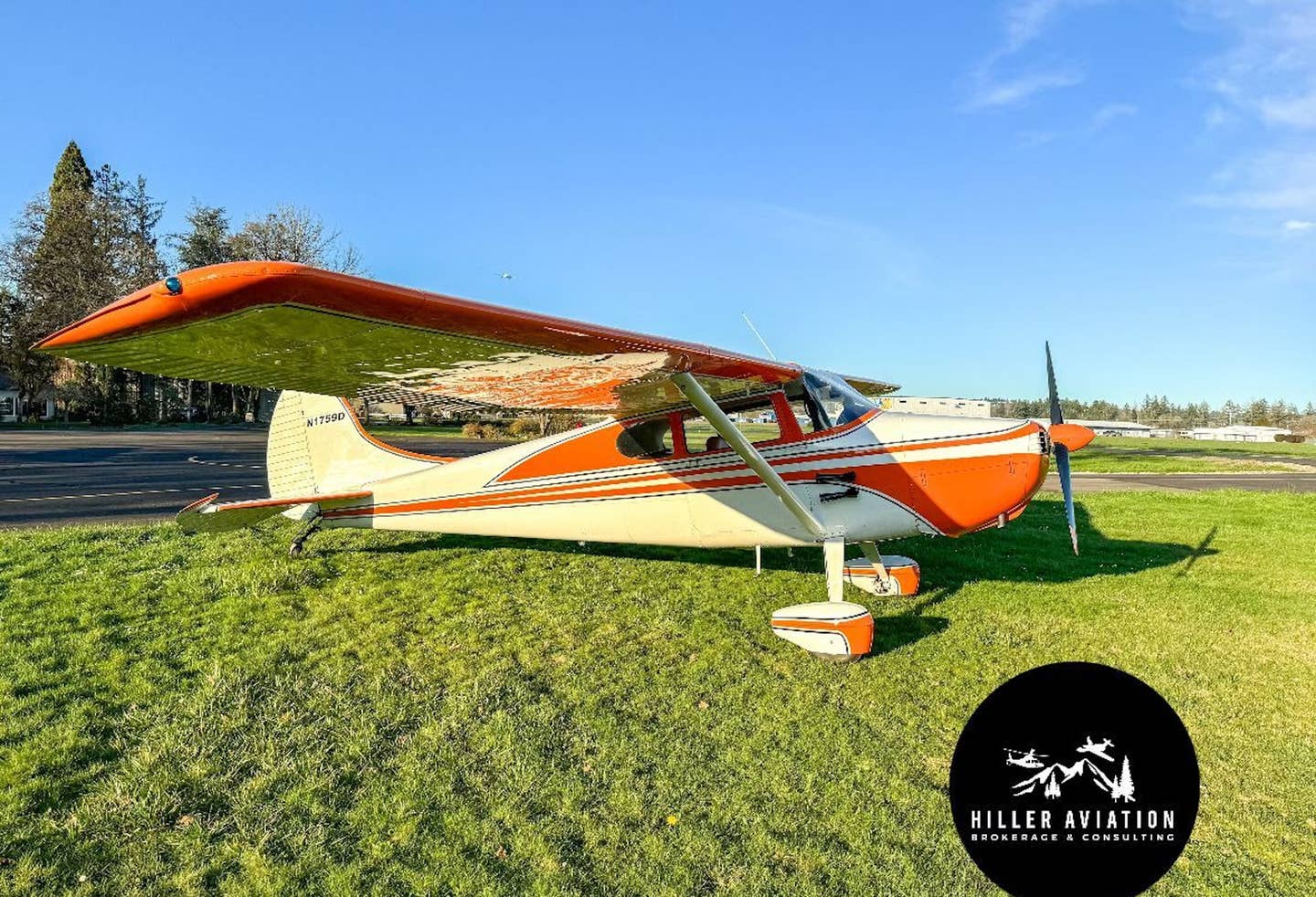
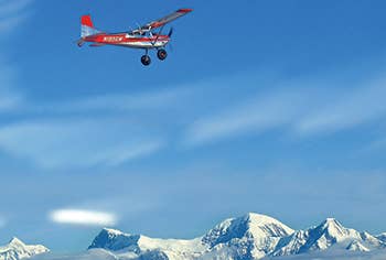
Friday morning we departed from Homer just before first light, heading north in two Cessna 185 taildraggers. Why two? Well, we had access to two 185s, we both enjoy flying, the aircraft perform better when flown light, and a second aircraft could be a rescue ship in the event of a mechanical or other problem in remote Alaska. Our optimistic objective was to reach our hunting area in the Brooks Range that day, but realistically we knew a lot would have to go well for that to work out. Our planned first leg was to Circle City, Alaska, a 100-person “city” located just south of the Arctic Circle. Circle City is the last convenient avgas stop north of Fairbanks toward our hunting area, and it has routing for terrain, about 450 nm away. We flew in loose formation, and soon we were level at 9,500 feet in smooth air, truing out around 145 knots with light winds. Our planned route of flight, which looked best for the weather and terrain, took us up the Kenai Peninsula over Anchorage, past Palmer, and then up the Matanuska River toward Gulkana.
My wife was flying a 1980 Cessna 185 we call Tigger. It has a larger IO-550 engine, a three-blade prop, 29-inch Alaska Bushwheel main tires, a baby Bushwheel tailwheel, titanium landing gear, Wing-X extensions, a Sportsman STOL leading edge cuff and vortex generators. This is an almost identical setup that our friend Rudi von Imhof used to win his class recently at the Valdez, Alaska, STOL contest. For avionics, it has a Garmin G500 flight display, a Garmin 530 and a Garmin handheld, which we use to display downloaded topographical information from Garmin Map Source. The airplane has a minimal interior to keep weight down, and we removed all the seats except for the pilot's.
I was flying a 1962 Cessna 185 we call Fireball. It is equipped similarly to Tigger, except that it has a mostly polished — in lieu of paint — exterior and an MT three-blade prop. About five years ago, after decades of Alaska air taxi use, it was completely restored. As an older-model 185, along with what Beegles Aircraft Service did in the remanufacturing process, it is one of the lightest 185s on the planet, with a useful load greater than its empty weight.
Reading the Signs
Halfway to Gulkana, we cut for the southern entrance to Isabel Pass, a good route through the higher terrain of the eastern section of the Alaska Range. We were pleased the ride was smooth, although halfway through the pass our groundspeed suddenly increased by 20 knots, and at the same time, we saw lenticular clouds in the lee of the sharp terrain ahead of us. You don’t need to be in law enforcement to recognize a clue, and shortly we encountered moderate-plus turbulence with downdrafts. We altered course to the east, and climbed to 11,500 feet, where we got farther away from the high terrain, and the ride settled down.
Soon we were north of Delta Junction. It was still too early in the morning to have to coordinate with Range Control, the coordinating frequency for separating bug smashers like us from the heavy and fast military aircraft whose operators train in this area. Crossing into the White Mountains, we were above a cloud and smoke layer. Looking down, we could see a cap cloud on one peak and waves in the smoke — another clue to stay high above it. Soon, with 3½ hours of flight behind us, we were descending into Circle City’s gravel runway, located not far from the bank of the Yukon River.
While there is no fuel at the airport, you can taxi off airport into “town,” where there is a gas station that also sells avgas. August is a busier time for aircraft traffic into Circle City, and the locals hardly give you a second look as you taxi down the road. With our longer leg behind us, we did our best to make a quick turn in Circle City and head out to our destination in the Brooks Range, about 200 miles farther north. We were hoping to get on the ground before daytime heating caused the air to deteriorate too much back in the mountains. An additional concern was the bad weather forecast for the weekend — if we couldn’t get in that afternoon, we might be sitting around a few days on a gravel bar or elsewhere waiting to get into the Brooks.
Climbing out of Circle City, we crossed the Yukon River and then passed north of the Arctic Circle just east of Fort Yukon, loosely following the Sheenjek River. We could sense the change in seasons, as what was green was now quickly turning brown. Reaching the area we were interested in, my wife, Charlie, circled a one-way strip lying on a riverbank, very reminiscent of Lower Loon in the Idaho backcountry, except half the length. After a few passes she landed, while I flew the area, looking around. I just didn’t get a good feeling about the hunting within reasonable hiking distance of that strip, and we decided to explore an area in a nearby drainage. The air was deteriorating by the minute, and we were burning gas.
Reaching the next area, it was hard to pick out the strip, even though we had a GPS waypoint from having overflown the landing spot just weeks earlier during a previous trip. The wind — 12 gusting 15 — was blowing up drainage, creating turbulence and forcing us to land downhill, with an awkward approach path over an obstacle and against the mountain wall. After a few passes, Charlie landed. It took me several passes just to get the orientation of the strip right, and more passes rolling my tires before I committed to landing. Standard remote Alaska rules applied: Look the strip over well enough to feel like the outcome is not in doubt before committing to the landing, but don’t take all day and a big chunk of your fuel while figuring it out. At that moment, I would have given a lot to be in my Husky, which was left at home, for the 50 knots greater speed of the 185.
Into the Mountains
Not long after I landed, it clouded over and the wind died down. While we were tired from the trip up, we dug into organizing our gear for five days hunting in the surrounding mountains. In Alaska, it is illegal to hunt most big game the same day you fly, but we wanted to get settled where we could camp and glass for Dall sheep so that we would have a chance the following day.
Despite the light rain, we headed up the drainage in high spirits. It took some effort to find a spot level enough to pitch our tent, and as soon as we got it up, our dog, Astro, ran Vizsla racetracks around the tent and then popped right in. There was still no sign of sheep, but our morning plan was to head farther up the drainage toward a glacier and glass areas not visible from below. In this game-management unit, only a ram with full curl horns or eight years of age is legal, and that means in many instances you need to study a sheep carefully to determine whether he is a legal animal.
At 7 a.m. we were under way. Reaching the head of the drainage, we scanned the area west but saw no sheep. We decided to drop our packs and climb 600 feet vertically to look from a different vantage point. There was still no sign of sheep, but we did see a large, lone, beautiful black wolf. We reversed course back down toward the airplanes and headed up another drainage. There, we spotted a group of caribou, and just as I was putting the spotting scope on them for amusement, Charlie announced she saw sheep behind us, far up a mountain. I got the spotting scope on the sheep, just as they became obscured by clouds. While we were certain they were rams, we couldn’t be sure they were legal from that distance. Charlie looked at a topographical map and estimated the sheep to be about five miles and 2,500 feet above us. It was noon, and since we had been hiking five hours already, we knew we had a long day ahead of us. Just as we were about to depart, a beautiful rainbow appeared on a nearby mountain, which we declared a positive omen.
Just before 5 p.m. we reached the bottom of a steep slope of talus and scree leading to the top of the mountain, which we hoped would allow us to hunt down onto the sheep. The slope was quite steep, about 1,500 feet of vertical, and we had a number of concerns — such as whether we could get up it without getting cliffed out, how it would be for Astro’s paws, and where it would put us relative to the position of the sheep that were out of sight. We decided to go for it, since we wouldn’t be harvesting a sheep down in the valley.
The rock was sharp, and Charlie managed to cut both her hands just by putting a palm down to steady herself against the slope. Astro managed to lose one of her two booties on the climb up, and Charlie was already worried about Astro’s paws on the way down. To top everything off, as soon as we got on top, it started blowing and snow began to fall, and clouds once again engulfed the mountain.
We discussed options — staying on top of the mountain to wait for the clouds to possibly clear, moving toward where we had last seen the sheep seven hours before, descending, or finding a place to camp. A small, sloping spot suitable for pitching a tent appeared on the summit, with a large rock blocking wind from the west, so we decided to set up our lightweight tent and spend the night there.
Just after 5 a.m. I sat up and immediately looked out — and was greeted with temperatures in the low 20s, 2 to 3 inches of fresh snow, mostly clear skies and a breathtaking view of the surrounding country from our perch on the top of our mountain. Everything was white, making our task of spotting white sheep a lot harder. We were warm as long as we stayed in the tent, or the wind didn’t blow hard. We were down to less than two quarts of water, and probably didn’t want to spend another night on top of the mountain with our lightweight down sleeping bags damp. After going back and forth between hanging out all day waiting on sheep or descending, we decided the prudent thing was to head down.
We made good progress heading down. Off the mountain, we moved as quickly as possible back to camp, which took us five hours. While we were all doing fine, we were still happy to see the airplanes.
Weather Whims
I tried to call Fairbanks Flight Service to get a weather outlook, but had trouble getting through without the Iridium sat phone dropping the call. What I did manage to hear was that we should leave the Brooks that afternoon or expect to be weathered in for a few days. We quickly organized to depart, as lowering clouds and rain started to encroach on our area. The good news was we would be able to depart into the wind downhill, and follow lowering terrain south.
Flying south, I couldn’t get over how much deeper into fall the colors looked in just the few days we had been there. The snow level was low all around, the light looked dimmer, and it was clear winter was knocking on the door. We didn’t have much of a weather briefing, and it took us more than 100 miles of flight south before we could reach Fairbanks Flight Service on the radio. Even so, reporting stations are few and far between in that part of Alaska. The weather was deteriorating, and by the time we were approaching Circle City, we were down low, following the Yukon River in low clouds, rain and reduced visibility. With a two-hour-plus flight up to our hunting area and another two hours back to Circle City, we were glad our Skywagons had the factory-optional large fuel tanks. After landing, we taxied back into town, knowing that we were in Circle for at least the night. The owners of the store in Circle were very gracious and allowed us to leave our airplanes in their parking lot, hook into their satellite Internet, and pitch our tent under a wing of one of our 185s.
The weather forecast for Monday was terrible, with a strong low pressure system forecast to influence the area. Tuesday morning, however, looked like a go, other than some possible wind around Mount McKinley. We launched well before 7 a.m., climbed above a cloud layer over the White Mountains, and made more or less a direct course for home. As we approached McKinley, the wind reached 40 knots and the clouds kept rising, forcing us higher. At 13,000 feet, we were getting some downdrafts but little turbulence, staring at a cap cloud over the 20,320-foot summit of McKinley and hoping the down-flowing air off the mountain didn’t reach us.
We were happy to reach the Palmer area and leave the mountains of the Alaska Range. Clear of the terrain, we started descending into thicker air and soon were making our approach into Homer. Back on the ground, we both felt like we had completed another great trip. While we didn’t get that Dall ram we wanted, we had flown the Skywagons off airport, camped on the top of the mountain above the sheep in the snow, seen a beautiful black wolf and a number of caribou bulls, spent some time in Circle City, and managed not to bend anything in the process.
We welcome your comments on flyingmag.com. In order to maintain a respectful environment, we ask that all comments be on-topic, respectful and spam-free. All comments made here are public and may be republished by Flying.

Sign-up for newsletters & special offers!
Get the latest FLYING stories & special offers delivered directly to your inbox


