Post-Cold Frontal Stratocumulus Clouds Create Recipe for Airframe Icing
Pilots should never allow themselves to be fooled by the snow.
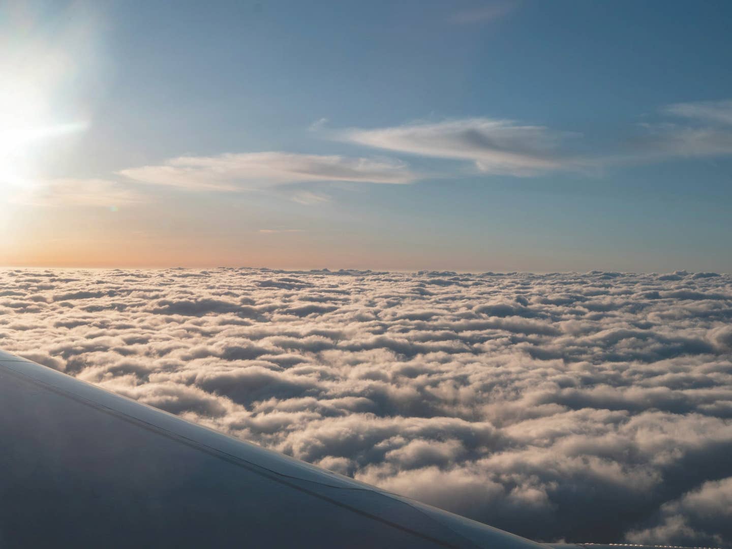
Airplane flying high above stratocumulus clouds during the morning sunrise. [Adobe Stock]
Are snow-producing clouds an airframe icing risk? The short answer is yes, which will likely surprise most readers who fly under instrument flight rules. While your mileage may vary, depending on the conditions, heavy ice within snow-producing clouds can even overwhelm an aircraft with a certified icing protection system.
In fact, a study done by Steven Green of Flight Operations Research suggests that if you look at icing accidents and incidents that occurred during which precipitation was reaching the surface, freezing precipitation (freezing rain or freezing drizzle) is present in 33 percent of the total events and snow is present in 32 percent of the events; these conditions are not mutually exclusive, as 7 percent of the events include both.
If you're not already a subscriber, what are you waiting for? Subscribe today to get the issue as soon as it is released in either Print or Digital formats.
Subscribe Now
Note that “events” are not always aircraft accidents resulting in injuries or fatalities, but also include the pilot/crew reporting a sharp reduction in airspeed, loss of control, hard landing, etc. due to airframe ice accretion.
First, a disclaimer. For those that are not a fan of the metric system, I am sorry to say that when airframe icing is discussed, the preferential temperature scale is degrees Celsius (C).
Next, let’s dig into some basic airframe icing facts.
Supercooled liquid water (SLW) is water in the liquid state when the static air temperature is below 0 C. In other words, water is happy to exist in a liquid form theoretically down to a temperature as cold as minus-40 C. Supercooled liquid water is what causes ice to accrete on the surfaces of the aircraft.
This typically occurs when an aircraft penetrates clouds containing supercooled liquid water. It may also occur during encounters with freezing precipitation such as freezing rain (FZRA) or freezing drizzle (FZDZ). At a temperature of minus-40 C or colder, homogeneous freezing occurs regardless of the pristine nature of the water. Even so, supercooled liquid water has a hard time surviving in very cold air, typically less than minus-22 C.
Ice crystals, on the other hand, are a result of the freezing or deposition process where water exists in the solid state. Ice crystals and their precipitation counterpart, namely, snowflakes, do not adhere to the airframe and are generally not considered an airframe icing hazard by themselves. However, exposure to high concentration of ice crystals (called high ice water content) in and near mesoscale convective systems can be a serious hazard to turbofan aircraft and has been known to cause adverse engine operation, engine flameout, even dual flameout.
- READ MORE: Take Advantage of Personalized Weather Training
The other potential ice crystal hazard in these aircraft is an uncommanded deceleration known as engine rollback which can lead to a slow reduction in power, autopilot nose-up pitch trim and slow decay in airspeed if unnoticed. High ice water content, however, isn’t a threat to piston or turboprop aircraft.
Snow falling from a cloud base is a good sign that the cloud producing them is dominated by ice crystals. So, it is easy to have a foredrawn conclusion that supercooled liquid water is absent, and therefore, there isn’t an icing risk in these snow-producing clouds. Just to be clear, this is referring to flight in the clouds producing the snow, not flying through snowfall below the base of the clouds. That’s an entirely different topic.
Left: Shown is the percentage of events (right) as it relates to the average precipitation events that occur in the U.S. (left). For example, freezing precipitation (FZRA and FZDZ) is involved in 33 percent of the events for which precipitation data was available, but only accounts for 1.8% of the reported surface precipitation in the U.S. Adapted chart courtesy of Steven Green. Right: A sample liquid water content trace measured by a research aircraft from Environment Canada is shown in the graph below. This particular stratocumulus deck that was penetrated has a depth of approximately 2,000 feet. The liquid water content is nearly zero at the cloud base and steadily increases to over 0.5 grams per cubic meter at the top of the cloud where it then quickly drops off to zero above the cloud where the air is clear. A supercooled liquid water content value of 0.5 gram per cubic meter can easily produce moderate airframe icing. [Courtesy: Scott Dennstaedt]
While there are important exceptions, precipitation falling through a cloud can lessen the icing threat within that cloud. Moreover, if the precipitation is snow, the threat of icing can be even less—but not zero. More on this in a bit
Essentially, snowfall can scour out the supercooled liquid water in the cloud. Assuming a static air temperature below 0 C within the cloud, any supercooled liquid water such as cloud drops may rime onto the snowflake, thus removing it from the cloud. This is not unlike supercooled liquid water riming onto your aircraft.
- READ MORE: What Are Known Icing Conditions?
In this mixed-phase scenario, ice crystals and snowflakes can also grow larger through deposition (water vapor deposits right onto the ice crystal) and liquid drops in the cloud tend to evaporate to compensate for this deposition process. It happens because water vapor will preferentially deposit on an ice crystal rather than condense back on a drop at colder temperatures. Therefore, a snow-producing cloud still may be in a mixed-phase state. That is, it will simultaneously contain both ice crystals and supercooled liquid water.
This is especially true when the snow falling is “showery.” Aircraft flying into weather that is producing snow showers will often report rime ice accretion. Normally the most significant accretion isn’t from the clouds producing the snow, but those around the snow-producing clouds. Those neighboring clouds normally contain the highest liquid water content.
During the cold season, it is quite common to find a blanket of stratocumulus clouds in the wake of a strong cold front.
Left: FlightAware tracks for two UPS Airlines Boeing 767 aircraft coming from England (top) and Seattle (bottom) arriving at the Louisville International Airport (KSDF) in the early morning hours. Right: Severe rime icing urgent pilot weather reports from two Boeing 767 aircraft. One reporting severe rime icing at 3,000 feet and the other reporting severe rime icing at 4,000 feet. SIGMET for severe ice issued by the Aviation Weather Center that was prompted by the severe icing report from the UPS Boeing 767 crew. [Courtesy: Scott Dennstaedt]
Stratocumulus clouds rarely have a depth of more than a few thousand feet. Even when it is cold enough for airframe icing, pilots are often tempted to climb or descend through this rather “thin” layer of clouds. While some stratocumulus decks can be quite harmless during the cold season even for an unprotected aircraft, they can dish out some of the most intense airframe icing that can quickly overwhelm many certified ice protection systems (IPSs).
Let’s take a look at a stratocumulus deck that produced severe icing conditions as reported by the crew of two Boeing 767s.
While a stratocumulus deck can be broken or even scattered it is quite common for these cloud decks to be overcast. They are rooted in the planetary boundary layer near the surface similar to other cumuliform-type clouds. An overcast stratocumulus deck can extend for hundreds of miles making them difficult to completely avoid.
Stratocumulus decks ordinarily have a depth of a few hundred to a few thousand feet. The air below and within the bases of stratocumulus clouds is rather unstable. However, the vertical growth of these clouds is limited by a strong capping temperature inversion. As unstable air rises from the surface it expands and cools until it reaches saturation. Once the saturated air reaches the base of the inversion layer it begins to slow its vertical ascent. Given that these updrafts carry some momentum, they will rise into the inversion layer a bit giving the tops that characteristic lumpy appearance. This is similar to what you may see on the surface of a pot of boiling water.
Left: The local NEXRAD depiction shows more widespread light snow east of the airport with snow showers moving through the region where two reports of severe icing occurred. Right: The color infrared satellite imagery confirms that the temperature of the cloud tops is minus-14 degrees Celsius, which means the cloud below is likely to a high supercooled liquid water content. [Courtesy: Scott Dennstaedt]
From an icing perspective, the other characteristic is the distribution of liquid water content in the clouds.
While not true of all cloud types, liquid water content in stratocumulus clouds generally increases with height through the cloud deck having the highest liquid water content near the cloud tops and the lowest in the bases. Therefore, stratocumulus clouds have their highest liquid water content at the tops where air is typically the coldest.
Now, let’s take a look at a case of a rather cold stratocumulus deck that dished out some nasty icing.
In the overnight hours on February 11, two UPS Airlines Boeing 767 freighters were headed to the Louisville International Airport (KSDF) in Kentucky. One was an international flight that originated in London, and the other was a domestic flight that originated in Seattle. They both arrived in the Louisville terminal area between 07Z and 08Z.
As both aircraft descended for an approach into Louisville, they were met with a cold and juicy snow-producing stratocumulus deck. As shown below, the crew of both aircraft filed an urgent pilot report (UUA) of severe rime icing at 3,000 feet and 4,000 feet, respectively. Take note that both of these aircraft are Boeing 767s—a heavy turbofan aircraft. The two reports were 43 minutes apart.
The first PIREP got the attention of forecasters at the Aviation Weather Center (AWC). At 0749Z, the AWC issued a SIGMET for occasional severe rime icing below 6,000 feet. As stated in the SIGMET text (i.e, RPTD BY ACFT).
Upon arrival into Louisville, both aircraft descended into this post-cold frontal stratocumulus deck. A few hours earlier, the surface cold front passed through the Louisville terminal area between 04Z and 05Z based on these recent surface observations below.
Notice the wind shift from the southwest at 0346Z to a gusty northwesterly direction at 0513Z with pressure steadily rising. Such a wind shift along with rising pressure is indicative of a frontal passage. Therefore, the airport and flight path of the two Boeing 767s were on the cold side of the cold front during their approach to land.
KSDF 110556Z 31012G22KT 8SM -SN SCT010 BKN020 OVC030 00/M03 A2999 RMK AO2 KSDF 110513Z 32017G25KT 5SM -SN BR BKN010 OVC015 01/M02 A2998 RMK AO2
KSDF 110456Z 29011G17KT 5SM -SN BR OVC009 02/00 A2997 RMK AO2 CIG 008V012 KSDF 110356Z 23007KT 4SM -SN BR BKN009 OVC015 01/00 A2996 RMK AO2 SLP149
KSDF 110346Z 23007KT 3SM -SN BR BKN009 OVC015 01/00 A2996 RMK AO2
The Louisville surface observations had been reporting light snow falling most of the evening. Snow falling from the base of a cloud deck ordinarily suggests less of an icing risk within the clouds producing the snow. However, based on the METAR remarks at 0739Z below, the icing environment went through a subtle change. The snow ended at 14 minutes after the hour and the Automated Surface Observing System (ASOS) reported unknown precipitation (UP) beginning at 28 minutes after the hour.
While not definitive, this implies a mixed precipitation event such as snow and drizzle or snow and rain. In both cases, the ASOS will automatically record unknown precipitation. Given the temperatures aloft, the snow was likely mixed with freezing drizzle, which implies a much more serious icing risk in the stratocumulus clouds above.
KSDF 110739Z 31018G26KT 10SM OVC013 M02/M04 A3002 RMK AO2 PK WND 31026/0739 UPB28E38SNE14 P0000
The ground-based radar also shows that a different environment moved into the area. The widespread snow passed through the Louisville airport about 0715Z and was now east of the airport. This is about the time the snow also ended at the airport.
Notice the cellular structure to the precipitation returns in the region just to the northwest of the airport. A cellular structure such as this implies showery precipitation and greater instability with some vertical ascent of air in the clouds which can condense out more moisture with liquid water content maximized near the tops.
Given this event occurred in the overnight hours, the visible satellite imagery is not available. Nevertheless, the color infrared satellite really tells a much better story when icing is a concern.
The key element found on this chart is the cloud top temperature. It is color coded using the scale at the bottom, which is in degrees Celsius. Most airframe icing occurs when the tops of the clouds are warmer than minus-15 C.
In fact, when cloud top temperatures are warmer than minus-12 C, the cloud below is almost guaranteed to be dominated by supercooled liquid water. The cloud top temperature is around minus-14 C in the area near the two pilot weather reports for severe ice. Based on the earlier reports of snow, unknown precipitation and the two urgent pilot reports of severe rime icing, this was definitely a mixed-phase scenario consisting of ice crystals and a rather high supercooled liquid water content.
The lesson to be learned here is that stratocumulus clouds are not usually very deep, but can create a nasty icing environment. Snow falling from a cloud deck is not a free ticket to climb or descend through the deck. It’s especially important when descending into such a cloud deck given that controllers often keep you right in the tops of this deck as you are being vectored for an approach to land. Most importantly, that’s usually the time you are slowing down the aircraft and it will often have a higher angle of attack. According to Green, most icing accidents and incidents occur when the aircraft is at a high angle of attack.
Even when the temperatures aloft are fairly cold and it is snowing from the base of the cloud deck, stratocumulus clouds can contain a huge amount of supercooled liquid water near the tops. Just remember that in the wake of a cold front that a rather shallow stratocumulus deck may be present.
If those clouds are producing precipitation, including light snow or mixed with rain or drizzle, and the temperature at the tops of those clouds are a bit on the warm side, post-cold frontal stratocumulus is a recipe for a significant encounter with moderate or even heavy airframe icing.
This feature first appeared in the December Issue 953 of the FLYING print edition.


Sign-up for newsletters & special offers!
Get the latest FLYING stories & special offers delivered directly to your inbox