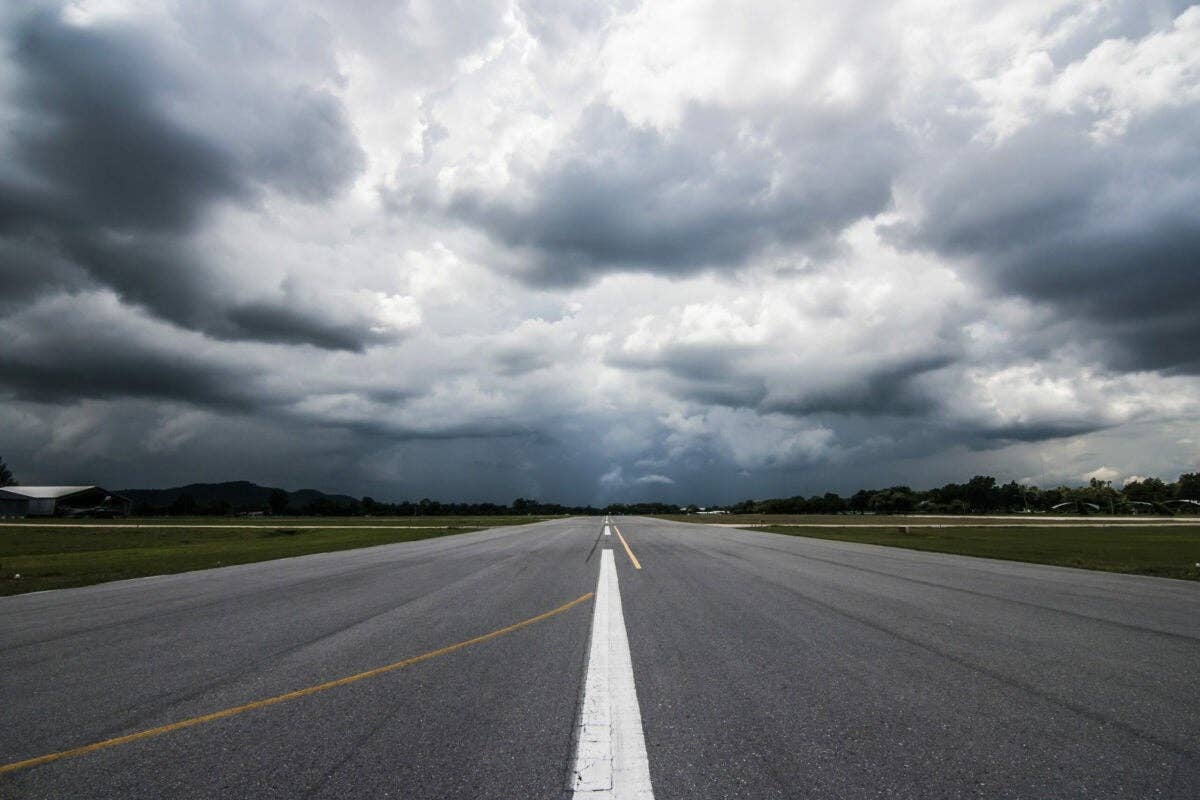
Thunderstorms are a fact of flying life, and so we avoid the worst echoes at all costs. How we avoid them matters, since the turbulence a storm creates can spread far from the core and deliver nasty surprises to pilots and passengers.
Despite the hard work from every segment of aviation, we have to reluctantly admit that there are still unforeseeable factors that can lead to incidents and accidents. From TWA Flight 800 to Air France 447, seemingly standard missions can be hit by disaster, with flight crews left unable to respond adequately, if at all. Through the efforts of the National Transportation Safety Board (and other investigative organizations), the FAA and the industry, these accidents are getting far less common as we create new guidelines to help us steer clear of disaster.
So it's frustrating to see incidents and accidents that are completely avoidable still taking place.
The most common of these are turbulence encounters that lead to injuries among cabin attendants and passengers. These mishaps are taking place on what seems to be a more regular basis. In his piece on how to use onboard active weather radar and even satellite-linked Nexrad radar to avoid areas of potential serious turbulence, renowned radar expert Archie Trammell offers practical guidance to those of us who find ourselves making the decisions that can lead to a thoroughly routine ride or one that's terribly hard to forget. —Robert Goyer
Ben Franklin said it 240 years ago: "An ounce of prevention is worth a pound of cure." We'd all best apply that ounce of prevention shortly, because events are indicating 2015 will be a year of thunderstorms like we've never seen before. Throughout 2014 the clues were stacking up. In a normal year, only three or four incidents find pilots flying into the tops of thunderstorms and experiencing severe turbulence. Last year such events happened at only three- to four-week intervals.
On April 29, 2014, a US Airways Boeing 757 encountered turbulence over Virginia between FL 360 and FL 370. Two flight attendants sustained critical injuries. In July a South African Airways Airbus A340 arrived in Hong Kong with 25 passengers and crew injured, two of them seriously, in a turbulence encounter. In August an Allegiant Air flight out of Fort Lauderdale, Florida, skimmed through the top of a thunderstorm and diverted all the way across the state to Clearwater, where an attendant and one passenger were hospitalized. The aircraft required a turbulence inspection.
That's only three of 13 turbulence upsets in 2014. Obviously a dramatic change has occurred in the world's atmosphere. The reason for the increase in those events is rapidly growing thunderstorms, which develop faster than they used to and, therefore, faster than pilots expect. Without getting wound up in the global warming debate and a mess of scientific stuff, the cause for that sudden rash of fast growing storms is transparent. Explosive thunderstorms result from hot, steamy air down low and a rapid cool-down with increasing altitude. No doubt, the atmosphere is getting warmer down low, but up high it hasn't changed, or at least it is warming at a slower rate.
For the airline business it's a major problem. For the rest of us, it's strong evidence that those same exploding thunderstorms are going to be a major threat for all pilots this coming spring and summer, whether flying high or low, whether radar-equipped or not. We'd best start immediately preparing many of those ounces of prevention, as old Ben suggested.
The cause of overflight turbulence events is no mystery: Pilots are inadequately trained in convective meteorology and the proper use of airborne radar.
First, pilots must be more aware of how fast a thunderstorm often grows in height. Scientist J.T. "Jean" Lee of the National Severe Storms Laboratory made the initial discovery 50 years ago while conducting "Operation Rough Rider" in Oklahoma. One summer day he was vectoring a pilot flying an Air Force F-100 across the top of growing storms, collecting data points. He directed the pilot across one at 20,000 feet. Immediately upon clearing its top the pilot hit afterburner and did a chandelle, intending to overfly it again. He was unable to catch it. That was out of 20,000 feet — in afterburner. They sometimes grow through FL 350, even FL 390, equally fast. In 1997 a United crew was flying a 757 at FL 370 over Montana, eastbound for New York. The nearest thunderstorm they'd seen was 50 nm away. Suddenly one popped up directly ahead, too late to be avoided. People ricocheted off the ceiling. The captain had to divert into Denver, where two seriously injured flight attendants were sent to a hospital and 20 passengers required first aid for cuts and bruises. According to the National Transportation Safety Board's report on the incident, the storm's growth rate was 5,000 to 7,000 fpm. That was through FL 370.
There's more. In his research Lee discovered that when a storm grows rapidly it pushes a bubble of clear air containing severe turbulence several thousand feet above it. Thus, a thunderstorm has a "radar top," the maximum height at which your airborne radar will detect it, plus a clear-air, nonradar-reflective region of significant turbulence above that. The bubble may add another 5, 10 or even 20 percent to the height of danger.
The second part of the cause for those incidents and injuries is faulty management of radar tilt. The reason for that must be laid at the feet of the radar manufacturers. Take this, for example, from the manufacturer's operating guide of a popular airline-class radar: "The best tilt angle lies where ground targets are barely visible or just off the radar range."
That's wrong. When tilt is set as that guide recommends, the bottom edge of the radar beam will be sloped down about 3. A minor amount of calculation will reveal that at five minutes ahead of the aircraft (about 39 nm at common high-altitude cruise speeds), the bottom of the radar beam will be sweeping 11,500 to 12,000 feet below the aircraft. (The formula is 100 x degrees x nautical miles.) So, flying at FL 370, the radar will not detect a storm less than about 25,000 feet tall five minutes ahead. It won't detect a little 20,000-foot buildup just ahead, one that you probably wouldn't even notice because it's so inconsequential to a flight at FL 370. But remember, that's the radar top. If it's a rapidly growing storm, add another 2,000 or 4,000 feet or more of hazard above it in the turbulent bubble. At five minutes away, the top of the actual hazard from a 20,000-foot-tall storm is 22,000 to 24,000 feet.
Bird's-eye views of the radar returns are of great help, but profile views, like this one from a Honeywell color radar display, provide invaluable help not only to avoid the storm but the turbulence associated with it.|
At FL 370 you're still OK, unless the storm and its bubble are growing 3,000 fpm or more, a not unusual case. If that's true, consider the situation three minutes later, when you're only two minutes from the cell. You're now just 15 or 16 nm from danger, and time has run out for a successful avoidance maneuver. That 20,000-foot storm's radar top will now have grown to about 29,000 feet; the bottom of your radar beam will be scanning down to about 4,500 or 4,600 feet below you, which is about 32,500 agl, so the storm topping out at 29,000 feet is still not being displayed on your radar. Nor is its hazardous bubble. However, in another two minutes, when you get to it, it'll have grown to 35,000 feet with a 3,000- to 5,000-foot-tall bubble of mayhem on top of that. See the problem? You're about to divert to the nearest hospital.
How can we prevent that sad outcome? Simply increase antenna down-tilt another degree. The bottom of your beam will now be sloped down about 4 rather than 3. Again, run through the math. At five minutes ahead of you, about 39 nm, the bottom of your beam will be scanning down to about 15,000 or 16,000 feet below you, or down to 21,000 or 22,000 feet agl. That 20,000-foot-tall storm won't be detected by your radar just yet, but at a growth rate of 3,000 fpm it will within the next 30 seconds and you'll still have four or so minutes, about 32 nm, to turn upwind around it.
Therefore, the simple rule becomes: Adjust tilt so the bottom of your radar's beam is angled down 4 and circumnavigate all echoes that drift back to 30 nm ahead on your radar display. In an area of known or forecast unstable atmosphere, -5 is better. Keep in mind that encounters with fast growing cells can and do occur at low and medium altitudes as well as up in the flight levels.
When operating up in the mid-30s, a simple way to adjust tilt so the bottom of the beam is sloped down to 4 is to first adjust the displayed range to 100 nm or greater and then adjust tilt so ground is being detected and painted from about 80 nm outward. That assumes flight over terrain no more than 2,000 feet above sea level. To select the proper "parked" tilt at other altitudes with a 28-inch antenna (most large airliners today), set tilt at -2; with an 18-inch antenna (CRJ aircraft), -1.5; with a fourteen-fifteenths-inch antenna (Hawkers), -0.5; and with a 12-inch antenna (all Citations and most other corporate jets), 0. With a stabilized antenna, once you've found the proper tilt selection, it doesn't change at other altitudes.
With that much down tilt you will, of course, see much terrain detected on your radar and become concerned about how to tell which are weather echoes and which are ground. It's very simple. Echoes with a radar shadow behind them are tall, menacing thunderstorms. Echoes that do not have a radar shadow behind them are either cities or simple rain showers. Echoes that have worked back out of the ground return to less than 80 nm are thunderstorms. Consider that look-down angle.
Avoidance is easy; with -4 downslope on the bottom of the beam, avoid all echoes detected at 30 nm or less and echoes with a radar shadow behind them. As a bonus, you'll have much improved situational awareness as you see familiar cities, towns, lakes and rivers drift by on your radar, even when flying in the dark above an overcast. That's backup for your GPS and VORs should those signals become corrupted. Try it. Your passengers will approve and those turbulence incidents will cease.
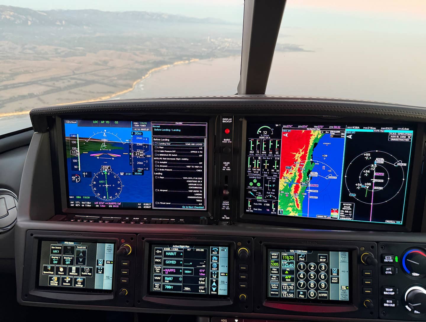
Now, what about when flying down low without radar? This will require more smarts and cunning than the high-altitude folks need. Of course, you most likely have uplinked Nexrad, and almost all Nexrad vendors now provide access to NOAA's CDM convective forecast planning (CCFP) data, which provides current storm heights and height trends of individual storm cells. The problem is that old bugaboo, time. When you see Nexrad information out there 30 or 40 nautical miles ahead, it's already five or 10 minutes old, or more. In addition, it's going to be another 10 or so minutes before you get to it. That 15 or 20 minutes is an eternity in the life span of a thunderstorm. In that time it may grow from a shower into a "supercell" thunderstorm.
The future of radar is a 3-D mosaic, as shown on this image from Honeywell. Such graphical views provide precipitation intensity and position, and wind shear, in one display to give pilots the best and clearest information possible.|
It's not important what a thunderstorm is when you see it. What's critical is what it is when you get to it. To get ahead of it, the first thing you must do each morning, shortly after getting out of bed, is take a quick look at the "AC Note" at spc.noaa.gov. Go to the "categorical" outlook on the right side, and you'll get a U.S. map showing where and what kind of thunderstorms are expected during the day. In the green areas expect air-mass thunderstorms; in yellow areas, moderately unstable atmosphere and possible severe thunderstorms; in red and magenta areas, very unstable atmosphere and extreme and fast growing storms. Across the top left of the map are tabs used to call up areas of possible very high winds, hail and tornadoes. Armed with that information, when Nexrad indicates weather ahead, you must then run down the list of meteorological indicators of potentially rapidly growing "supercell" storms.
The indicators of a supercell are:
1. Evidence of Atmospheric Instability — Check the AC Note. It will tell you with a glance where those fast growing thunderstorms are most likely to occur. In red and magenta areas you would be wise to circumnavigate all echoes displayed, the green as well as the red and magenta parts of them. (Extreme turbulence and/or large hail may be encountered in the green parts of a storm system and even up to 10 or 20 nm outside the entire echo, green parts of it included.)
2. A Dew Point of 10 Degrees C or Greater — The fuel of a thunderstorm is water vapor. The higher the dew point, the greater the fuel available to power an atmospheric explosion.
3. A Temperature/Dew-Point Spread Greater than 17 Degrees C — A high temperature/dew-point spread indicates a dry atmosphere, which is no problem, unless there is a high-based shower above. In that case, as water from the shower above falls into that dry, warm situation at the surface, it will evaporate, becoming water vapor. When it does, it takes on latent heat. Heat rises, leaving a vacuum below into which more water drops fall, evaporate and rise. In the meantime, that warm water vapor going aloft cools a little and condenses back into water drops. As it does it gives up its latent heat into the atmosphere. Warm air rises. Warm water vapor rises, condenses, gives up latent heat, and more and more and more. Then boom! The entire mess explodes upward into a huge mass of water, boiling up and up to 40,000, 45,000, 50,000 feet. It's hard to believe, but scientists have calculated that more than 3 million tons of water may be lifted in the process, after which it often falls as a massive microburst.
4. The Southernmost Cell in a Line (U.S.) — Since thunderstorm explosions grow on an abundance of water vapor, there must be a source for it. What better source than warm waters off the Gulf of Mexico? It's no surprise that in the United States the southernmost cell is most likely to be the one that explodes. Which leads to another fact: The cell on the north side of a gap in a line of storms must be feared most. The same goes for a storm that has moved out in front of a line. Often a line of storms will churn across the country west to east with cells in the center of the line getting ahead of others, resulting in a bow-shaped line, bowed toward the east. In that event, thunderstorms toward the north end of the line will become dominant. (This gives nonradar pilots a leg up on those that have it; a bowed line is most easily recognized on Nexrad compared with airborne radar.) Finally, it must be noted that the Gulf Stream flows up the East Coast of the United States, carrying warm water and consequent water vapor with it. Hence, along the East Coast be leery of storms that are southeast of others. (In other parts of the world, know where large bodies of warm water are and what the prevailing wind flow across them is.)
5. Odd-Shaped Echoes — Simple air-mass storms tend to be roundish with no protrusions; storms with a lot of churning going on inside them develop weird shapes. For instance, a vigorous storm sucking in massive amounts of air and water vapor will often develop a notch on the southeast side. The scientific name for it is a "bounded weak echo region." It's hard to spot on uplinked Nexrad, but let any evidence of a BWER in an echo be the clue to a very dangerous storm. Also, sometimes a tall storm will be impacted by a jet stream. The result is its top will tend to get pushed downwind with its lower part moving more slowly over the ground. The result will be a pendant-shaped echo with the pointy end to the west or southwest and the fat end to the east or northeast. Pendant-shaped echoes are easily spotted on Nexrad. When you see one, avoid it to the west, which is upwind, if possible. If not, figure on a minimum circumnavigation 20 nm to the east, although 30 nm is better.
6. A Line of Storms with No Breaks — This is of course an indication of a front of some sort. If it's a front stretched across your route and you're westbound in the United States, the best advice is to land and let it pass over you. If eastbound, listen on the frequency for talk about ends or big gaps. Also, talk to Flight Watch about the prospects of an end run. If it's a line formed on the outflows from big storms, be especially cautious. Should the dew point be high or the temperature/dew-point spread greater than 17 degrees Celsius, be a coward.
7. Echoes in a Cluster — Another danger sign readily apparent on Nexrad is a gathering of cells. When three or more echoes are in close proximity, there's a concentrated area of moisture and instability in that location, no doubt. Be wary of sudden strong outflow/inflow gusts when conducting airport operations within 10 to 20 nm of the cluster. Those sudden gusts may be inward or outward. They may be accompanied by severe, even extreme, turbulence.
8. An ATC Warning of "Extreme" Echoes — Today we're given the following echo types: light, moderate, heavy and extreme. When you hear extreme, you don't know whether you should avoid it or circumnavigate it by 20 nm. In the absence of other input, make it 20 nm to be safe and avoid the hail.
9. Deep Red or Magenta Echoes on Nexrad — In truth, Nexrad colors are a slight bit more descriptive of hazard potential than the new meaningless names. When you see the deepest red, assume that hail and tornadoes are probable. Avoid it by 10 nm, although 20 nm is better. If you see magenta on Nexrad you can be 99 percent certain there's large hail nearby with a high possibility of tornadoes and rain intense enough to drown a tadpole.
10. Requests for Deviations from Airline Crews — These are a positive indication of high-altitude storms, and high-altitude storms are always bad news for lower-altitude pilots. Turbulent skies in the vicinity are certain, hail of some size very likely and extreme rain rates possible, and high-velocity surface gusts could nip you during a takeoff or landing.
The list could go on and on. Virga, dust devils, blowing dust, pireps, forecasts. But the 10 above are basic to the formation of those fast growing storms that trigger turbulence injury events. Of course, no one of those risks by itself need be of concern. It's when they stack up that pilots must become crafty. In an area where two or three are positive, expect trouble. If there are more than three, expect big, big trouble. An ounce of prevention, you know.
Get online content like this delivered straight to your inbox by signing up for our free enewsletter.

Sign-up for newsletters & special offers!
Get the latest FLYING stories & special offers delivered directly to your inbox

