When Curse of Haze Close In, Pilots Beware
There’s a reason the name for weather event is a synonym for confused.
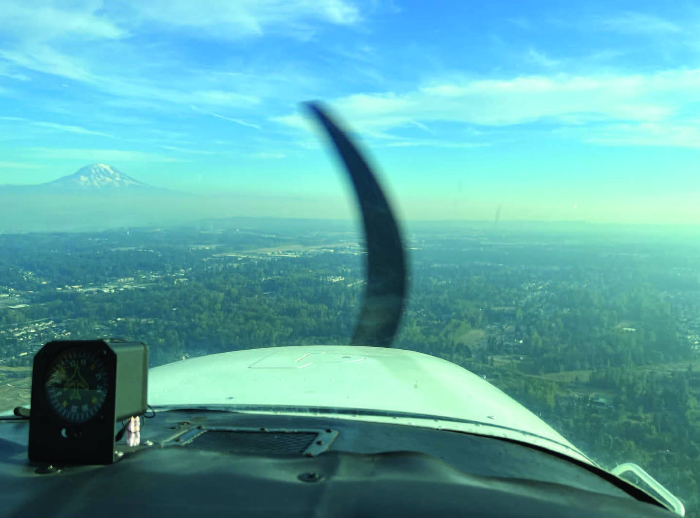
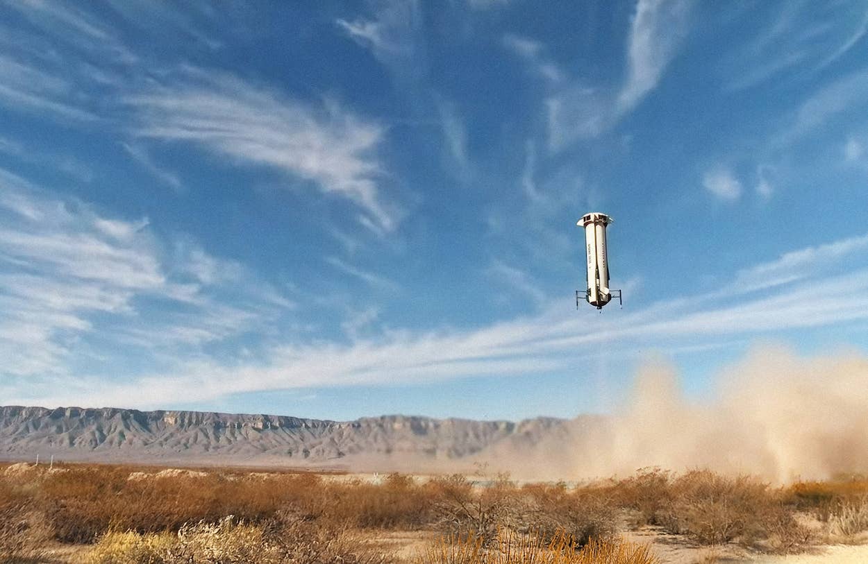
The accident reports compiled by the National Transportation Safety Board include a fair number that cite haze as a causal factor. [Courtesy: Meg Godlewski]
“I don’t think it’s ever been this smooth before,” the learner remarked as we headed east toward the practice area.
Most of his training was done in the summer, in the afternoon no less, when thermals at low altitude batted around the Cessna 172 like a cat toy. This early fall afternoon was refreshing—the air mass was stable, the air calm, and the clouds were up high and looked like a watercolor wash in painting. The trees below us were coming into their autumnal colors, and pumpkin patches dotted the landscape. There was the faint smell of wood smoke in the air as it was cool enough for some folks to fire up their stoves.
If you're not already a subscriber, what are you waiting for? Subscribe today to get the issue as soon as it is released in either Print or Digital formats.
Subscribe Now
“What’s the reported visibility today?” I asked, knowing full well what the answer would be.
“Seven miles,” the learner replied. Learning was about to take place.
A few clearing turns and ground reference maneuvers later, we decided to head back to the airport. The learner dialed in the AWOS and noted the temperature dew point spread was a good distance apart, and there was no ceiling or winds reported.
As we turned back to the southwest, the learner let out a noise of surprise. It was late afternoon, and the sky to the west was almost opaque gold. Hello, haze. It’s been awhile since we’ve seen you.
- READ MORE: How to Handle Winter Flying
Haze is formed when water vapor condenses around a nucleus, such as smoke or salt particles, and we have both in the Seattle area. Visibility often goes downhill rapidly, especially when you are heading toward the sun.
There have been times when pilots flew around looking for the airport, which was hidden as it blended into the monochromatic ground below. Sometimes the haze is so bad and air quality so poor burn bans are put into effect. On the ground, it means you can’t use a wood stove unless it is your only source of heat.
And for the pilots, the visibility in the daytime is like being inside a dirty fish tank. When you get above the haze layer, it looks like a bathtub ring. Visibility usually doesn’t improve until it rains or the front moves on.
The TAFs and METARs can still be reporting VFR conditions, but haze makes it very difficult to see any detail on the ground as your eyes tend to focus to infinity, so it is a challenge to gauge distances.
The learner noted this was skeptical of the “7 miles visibility” stated in the weather reports and guessed we were about 20 miles from the airport. He could barely make out the white roofs of the hangars. A few keystrokes on the GPS revealed the truth: We were 11 miles from the airport.
The Curse of Haze
The accident reports compiled by the National Transportation Safety Board include a fair number that cite haze as a causal factor. Pilots misjudge their altitude and distance to the runway on final approach and either land short or land hard.
Haze also makes it more difficult to see other aircraft in the air. Often your eyes will pick up movement, and a second look verifies it is an airplane. Turning on all available exterior lights can also help make you more visible, especially if the aircraft is equipped with strobes.
- READ MORE: Learning to Fly the NDB
There are some tools to help a pilot in haze, such as sunglasses designed to help improve your visual acuity. However, keep in mind they may not interface well if you have an aircraft equipped with a glass cockpit.
ADS-B can help with situational awareness as it warns us when traffic is near, and we hope the other aircraft gets the same warning. That’s how it is supposed to work. It doesn’t always, and it is a little chilling to get a traffic warning and look and look but not see it. Or to see another aircraft but not get any warning although you are in an area where ADS-B is required.
Talk to Me, Goose
If there is a recommended self-announce frequency for the practice area (check the TAC or ForeFlight), at least monitor it so you hear where the other aircraft are.
Pilots who use the frequency often state their tail number or type and color of aircraft (for example, red and white high wing) and location, altitude, and intention: “Southeast practice area, red-and-white high-wing over Evergreen Sky Ranch, 3,300 slow flight, southeast practice area.”
- READ MORE: Mastering Descent Is an Art Form
If you don’t know the landmarks in the area, make a point to fly with an instructor or another pilot who does know them and can point them out.
Finding Your Way Home
If the aircraft you are flying is not equipped for instrument flight or if you are not IFR certified or current, getting back to your home airport can be challenging.
On this day, the learner, with a little coaching, identified landmarks that he could still see in the haze. We were lucky as it was late afternoon and, as dusk fell, the cars on the roads started to use their headlights, and the learner identified the freeway and the busy arterial that ran parallel to the airport. He’d go back IFR, as in “I Follow Roads,” if he had to, he said.
If you do this, pay attention to the altimeter as well as looking outside. In the flat evening light it can be difficult to determine if you are drifting down, so pay attention to inside as well as outside visual cues.
If the aircraft is equipped for instrument flight, and you have the rating, be prepared to use it.
On this particular evening an IFR clearance was obtained and the approach for the RNAV 35 was loaded and flown. I handled the radios and talked the learner through the procedure. Even though we were not technically in IFR conditions—the visibility was at least 5 miles— there was a greater degree of confidence as the learner flew the published altitudes and headings on the approach. It also inspired him to pursue an instrument rating.
My work here was done.
Top-Selling Aviation Headsets
This column first appeared in the December Issue 953 of the FLYING print edition.


Sign-up for newsletters & special offers!
Get the latest FLYING stories & special offers delivered directly to your inbox